Showing posts with label europe. Show all posts

Tuesday, September 27, 2022

Ukraine: Map of Russian Control - September 2022 (Subscription)

SUBSCRIBERS CLICK HERE TO VIEW FULL ARTICLE AND MAP:
Old Portal (members.polgeonow.com) | New Portal (controlmaps.polgeonow.com)


There are newer versions of this map available. To see them, view all Ukraine articles on PolGeoNow.

Research by Djordje Djukic. Map by Evan Centanni and Djordje Djukic
Subscribe for full access to all conflict map reports!

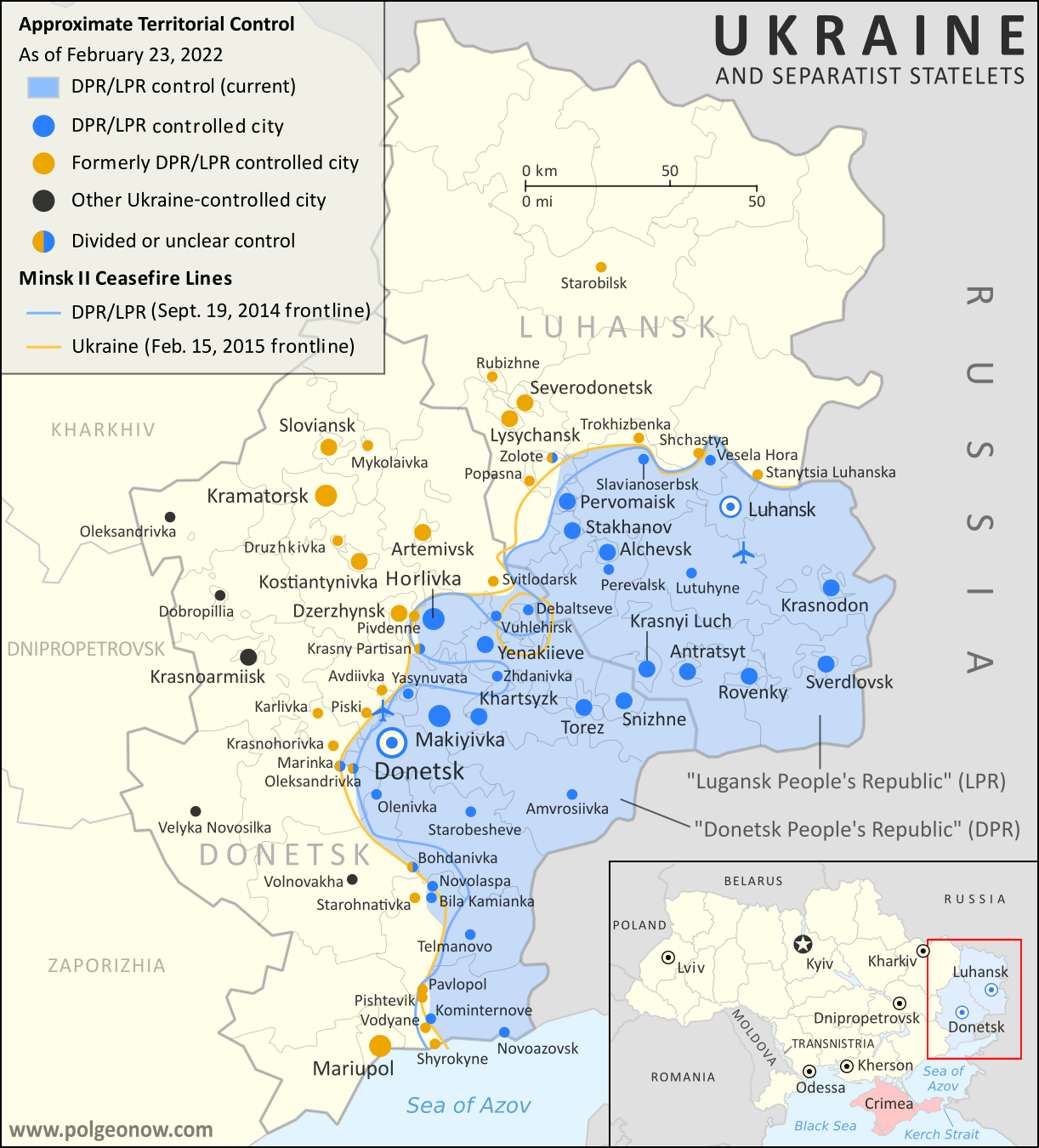
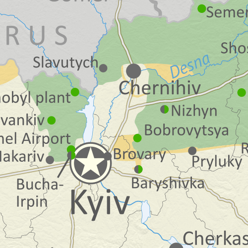
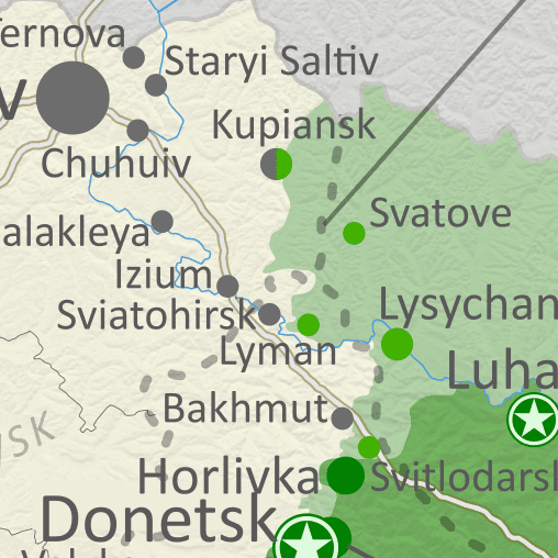
Thumbnail previewing map of Russian-controlled territory in Ukraine on September 26, 2022. In addition to the Crimean peninsula, which Russia had already seized in 2014, and parts of the far eastern Donetsk and Luhansk provinces (the Donbass region) already controlled by Russia-backed separatist rebels (and declared independent as the Donetsk and Lugansk People's Republics), Russian forces now control a large strip of territory just north of Crimea, including Kherson city and parts of Mariupol, as well as all of Luhansk province and large additional areas of Donetsk provinces, but have lost most of their territory in Kharkiv province after a recent Ukrainian offensive. Map includes key locations from the news, such as Izium, Vysokopillia, Lyman, Pisky, Krasnohorivka, and many more. Colorblind accessible. Though slow Russian advances have continued in some areas, recent weeks have also seen a string of major Ukrainian victories, which have pushed Russian forces out of most of the areas they had controlled in Kharkiv province.

See all this and more on the latest update to PolGeoNow's concise, professional Ukraine war control map, which includes a detailed chronicle of changes and events since our previous Ukraine map report of August 22, with sources cited, as well as a close-up map of control within the claimed borders of the Donetsk and Lugansk People's Republics.


This map and report are premium content, available to paid subscribers of the PolGeoNow Conflict Mapping Service.

Want to see before you subscribe? Check out our most recent FREE SAMPLE Ukraine map!

Exclusive map report includes:

  • Up-to-date illustration of current territorial control in Ukraine, color-coded for the Ukrainian government on one side and the Russian military and allied rebels on the other side, with areas of uncertainty indicated. Colorblind accessible.
  • Darker color indicating which areas were already under Russian or allied control before the 2022 invasion began
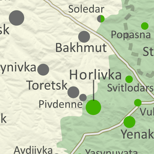
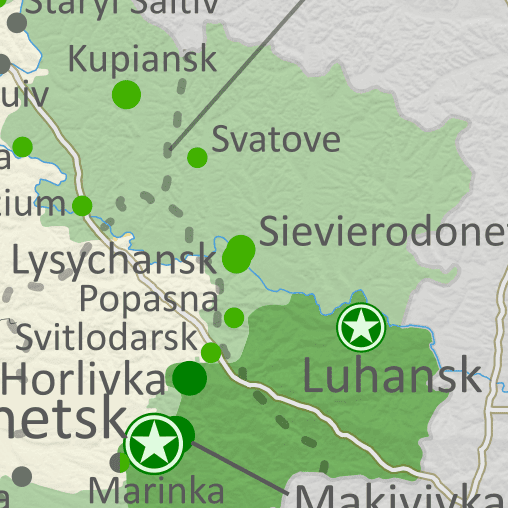
  • Preview thumbnail of map of territorial control within the claimed borders of the self-declared Donetsk People's Republic (DPR) and Lugansk People's Republic (LPR), updated to September 26, 2022, six months into the Russian invasion of Ukraine. Map shows that all of the LPR, otherwise known as Ukraine's Luhansk province, is now under the control of Russian and LPR forces, while Russian and DPR forces control over half of the DPR, or Ukraine's Donetsk province, including the major central and southern cities of Donetsk, Horlivka, Makiyivka, and Mariupol. Colorblind accessible.
    Donbas close-up map
    Close-up map of territorial control within the self-proclaimed borders of the Donetsk People's Republic and Lugansk People's Republic (based on the design of our classic map of rebel control in the Donbas, upgraded to include roads and terrain)
  • Detailed indication of city-by-city control, including key towns and other locations important to current events
  • Locations of recent control changes and other important events, including Izium, Vysokopillia, Lyman, Pisky, Krasnohorivka, and many more
  • Detailed timeline of important events and changes to territorial control since August 22, 2022, with links to sources.

SUBSCRIBERS CLICK HERE TO VIEW FULL ARTICLE AND MAP:
Old Portal (members.polgeonow.com) | New Portal (controlmaps.polgeonow.com)


Not signed up yet? Click here to learn more about our professional subscription service!

Can I purchase just this map?
This map and report are not available for automated purchase to non-subscribers. If you need access or republication rights for only this map report, contact service@polgeonow.com for options.

Friday, September 9, 2022

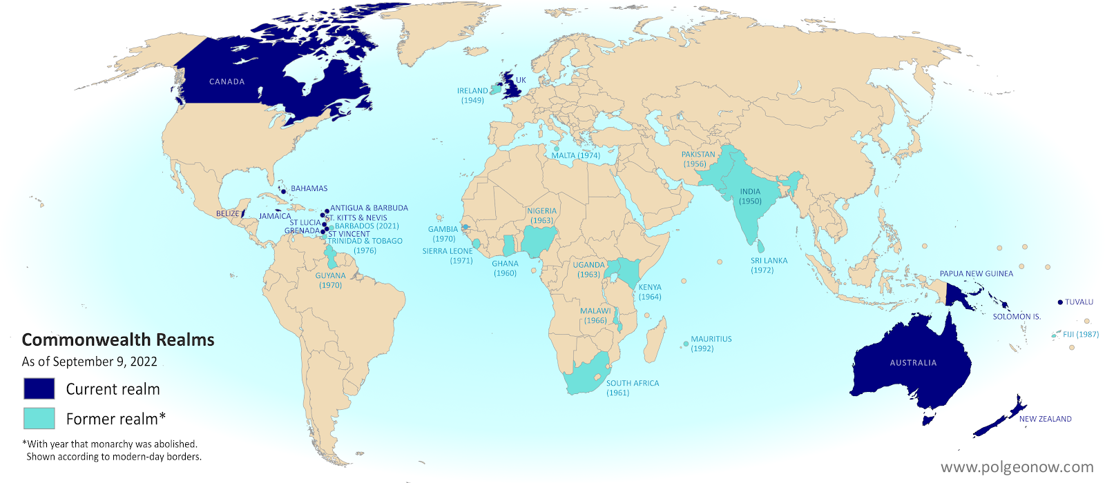
King Charles's 15 Countries: The Commonwealth Realms

Did you know the new King Charles III isn't just the King of England and the larger UK, but of 14 other independent countries? If that statement just raises more questions for you, read on for all the answers...

Map of countries with King Charles III as head of state, which are known as the Commonwealth realms. Includes the UK, Canada, Australia, and a number of small countries in Oceania and the Caribbean. Also shows former Commonwealth realms, including large parts of Africa and South Asia. Colorblind accessible.
Map of the Commonwealth realms (independent countries that share the monarchy with Britain). Click to enlarge. Contact us for permission to use this map.


This article, originally written during the reign of Queen Elizabeth II, has been revised and updated to for the passing of the throne to her son, King Charles III.

Which countries does King Charles reign over?

You might be surprised to learn that King Charles III is the official king of 15 different independent countries. Those countries are together known as the "Commonwealth realms" - a smaller subset of the Commonwealth of Nations, which also includes many kingless republics. Every one of the 15 Commonwealth realms is considered a fully-fledged independent country and a member of the UN, despite sharing the same monarch. 

Friday, August 26, 2022

Ukraine: Map of Russian Control - August 2022 (Subscription)

SUBSCRIBERS CLICK HERE TO VIEW FULL ARTICLE AND MAP:
Old Portal (members.polgeonow.com) | New Portal (controlmaps.polgeonow.com)


There are newer versions of this map available. To see them, view all Ukraine articles on PolGeoNow.

Research by Djordje Djukic. Map by Evan Centanni and Djordje Djukic

Subscribe for full access to all conflict map reports!

Thumbnail previewing map of Russian-controlled territory in Ukraine on August 22, 2022. In addition to the Crimean peninsula, which Russia had already seized in 2014, and parts of the far eastern Donetsk and Luhansk provinces (the Donbass region) already controlled by Russia-backed separatist rebels (and declared independent as the Donetsk and Lugansk People's Republics), Russian forces now control a large strip of territory just north of Crimea, including Kherson city and parts of Mariupol, as well as all of Luhansk province and large additional areas of Donetsk and Kharkiv  provinces. Map includes key locations from the news, such as Bakhmut, Marinka, Balakleya, the location of explosions in Crimea, and more. Colorblind accessible. Since last month, Russia and its local allies have continued advances in the east, but at a relatively slow pace. Ukraine's military, meanwhile, has made some smaller advances of its own, but plans to retake Kherson in the south haven't yet materialized.

See all this and more on the latest update to PolGeoNow's concise, professional Ukraine war control map, which includes a detailed chronicle of changes and events since our previous Ukraine map report of July 9, with sources cited, as well as a close-up map of control within the claimed borders of the Donetsk and Lugansk People's Republics.


This map and report are premium content, available to paid subscribers of the PolGeoNow Conflict Mapping Service.

Want to see before you subscribe? Check out our most recent FREE SAMPLE Ukraine map!

Exclusive map report includes:

  • Up-to-date illustration of current territorial control in Ukraine, color-coded for the Ukrainian government on one side and the Russian military and allied rebels on the other side, with areas of uncertainty indicated. Colorblind accessible.
  • Darker color indicating which areas were already under Russian or allied control before the 2022 invasion began
  • Preview thumbnail of map of territorial control within the claimed borders of the self-declared Donetsk People's Republic (DPR) and Lugansk People's Republic (LPR), updated to August 22, 2022, six months into the Russian invasion of Ukraine. Map shows that all of the LPR, otherwise known as Ukraine's Luhansk province, is now under the control of Russian and LPR forces, while Russian and DPR forces control over half of the DPR, or Ukraine's Donetsk province, including the major central and southern cities of Donetsk, Horlivka, Makiyivka, and Mariupol. Colorblind accessible.
    Donbas close-up map
    Close-up map of territorial control within the self-proclaimed borders of the Donetsk People's Republic and Lugansk People's Republic (based on the design of our classic map of rebel control in the Donbas, upgraded to include roads and terrain)
  • Detailed indication of city-by-city control, including key towns and other locations important to current events
  • Locations of recent control changes and other important events, including Bakhmut, Soledar, Siversk, the location of explosions in Crimea, and more
  • Detailed timeline of important events and changes to territorial control since July 9, 2022, with links to sources.

SUBSCRIBERS CLICK HERE TO VIEW FULL ARTICLE AND MAP:
Old Portal (members.polgeonow.com) | New Portal (controlmaps.polgeonow.com)


Not signed up yet? Click here to learn more about our professional subscription service!

Can I purchase just this map?
This map and report are not available for automated purchase to non-subscribers. If you need access or republication rights for only this map report, contact service@polgeonow.com for options.

Tuesday, July 12, 2022

Ukraine: Map of Russian Control on July 9, 2022 - Luhansk Fully Captured (Subscription)

SUBSCRIBERS CLICK HERE TO VIEW FULL ARTICLE AND MAP:
Old Portal (members.polgeonow.com) | New Portal (controlmaps.polgeonow.com)


There are newer versions of this map available. To see them, view all Ukraine articles on PolGeoNow.

Research by Djordje Djukic. Map by Evan Centanni and Djordje Djukic

Subscribe for full access to all conflict map reports!

Thumbail previewing map of Russian-controlled territory in Ukraine on July 9, 2022). In addition to the Crimean peninsula, which Russia had already seized in 2014, and parts of the far eastern Donetsk and Luhansk provinces (the Donbass region) already controlled by Russia-backed separatist rebels (and declared independent as the Donetsk and Lugansk People's Republics), Russian forces now control a large strip of territory just north of Crimea, including Kherson city and parts of Mariupol, as well as all of Luhansk province and large additional areas of Donetsk and Kharkiv  provinces. Map includes key locations from the news, such as Sievierodonetsk, Lysychansk, Izium, Popasna, Snake Island, and more. Colorblind accessible. In the past month, Russia and its allies from the self-proclaimed Lugansk People's Republic (LPR) have completed their control of the area corresponding to Ukraine's Luhansk province - the first time since 2014 that it hasn't been divided between the Ukrainian government and LPR/Russian control.

See all this and more on the latest update to PolGeoNow's concise, professional Ukraine war control map, which includes a detailed chronicle of changes and events since our previous Ukraine map report of June 13, with sources cited, as well as a close-up map of control within the claimed borders of the Donetsk and Lugansk People's Republics.


This map and report are premium content, available to paid subscribers of the PolGeoNow Conflict Mapping Service.

Want to see before you subscribe? Check out our most recent FREE SAMPLE Ukraine map!

Exclusive map report includes:

  • Up-to-date illustration of current territorial control in Ukraine, color-coded for the Ukrainian government on one side and the Russian military and allied rebels on the other side, with areas of uncertainty indicated. Colorblind accessible.
  • Darker color indicating which areas were already under Russian or allied control before the 2022 invasion began
  • Donbas close-up map
    Close-up map of territorial control within the self-proclaimed borders of the Donetsk People's Republic and Lugansk People's Republic (based on the design of our old map of rebel control in the Donbas)
  • NEW: Donetsk and Lugansk close-up map has been upgraded to include terrain and major rivers and roads
  • Detailed indication of city-by-city control, including key towns and other locations important to current events
  • Locations of recent control changes and other important events, including Sievierodonetsk, Lysychansk, Bilohorivka, Bohorodychne, Snake Island, and more
  • Detailed timeline of important events and changes to territorial control since June 13, 2022, with links to sources.

SUBSCRIBERS CLICK HERE TO VIEW FULL ARTICLE AND MAP:
Old Portal (members.polgeonow.com) | New Portal (controlmaps.polgeonow.com)


Not signed up yet? Click here to learn more about our professional subscription service!

Can I purchase just this map?
This map and report are not available for automated purchase to non-subscribers. If you need access or republication rights for only this map report, contact service@polgeonow.com for options.
Thursday, June 16, 2022

Ukraine: Map of Russian Control on June 13, 2022 (Subscription)

SUBSCRIBERS CLICK HERE TO VIEW FULL ARTICLE AND MAP:
Old Portal (members.polgeonow.com) | New Portal (controlmaps.polgeonow.com)


There are newer versions of this map available. To see them, view all Ukraine articles on PolGeoNow.

Research by Djordje Djukic. Map by Evan Centanni and Djordje Djukic

Subscribe for full access to all conflict map reports!

Thumbail previwing map of Russian-controlled territory in Ukraine on June 13, 2022). In addition to the Crimean peninsula, which Russia had already seized in 2014, and parts of the far eastern Donetsk and Luhansk provinces (the Donbass region) already controlled by Russia-backed separatist rebels (and declared independent as the Donetsk and Lugansk People's Republics), Russian forces control a large strip of territory just north of Crimea, including Kherson city and parts of Mariupol, as well as large additional areas of Donetsk and Luhansk, and other areas of Ukraine's northeast. Ukrainian capital city Kyiv (Kiev) is no longer under siege. Map includes key locations from the news, such as Ternova, Sviatohirsk, Davydiv Brid, the Azot chemical plant in Sievierodonetsk, and more. Colorblind accessible. In recent weeks, Russia and its allies in Donetsk and Luhansk have maintained the upper hand in their fight against Ukraine's government, defending most of the frontlines and nearly completing the capture of Sievierodonetsk, the biggest remaining Ukraine-held city claimed by the self-declared Lugansk People's Republic. 

This update also sees the return of our old map of rebel control in eastern Ukraine, re-imagined as a close-up illustration of remaining Ukrainian control within the claimed borders of the self-proclaimed Donetsk and Lugansk People's Republics.

See all this and more on the latest update to PolGeoNow's concise, professional Ukraine war control map, which includes a timeline of changes since our previous Ukraine map report of May 19, with sources cited.


This map and report are premium content, available to paid subscribers of the PolGeoNow Conflict Mapping Service.

Want to see before you subscribe? Check out our most recent FREE SAMPLE Ukraine map!

Exclusive map report includes:

  • Up-to-date illustration of current territorial control in Ukraine, color-coded for the Ukrainian government on one side and the Russian military and allied rebels on the other side, with areas of uncertainty indicated. Colorblind accessible.
  • Darker color indicating which areas were already under Russian or allied control before the 2022 invasion began
  • NEW: Close-up map of territorial control within the self-proclaimed borders of the Donetsk People's Republic and Lugansk People's Republic (based on the design of our old map of rebel control in the Donbas)
  • Detailed indication of city-by-city control, including key towns and other locations important to current events
  • Locations of recent control changes and other important events, including Ternova, Sviatohirsk, Davydiv Brid, the Azot chemical plant in Sievierodonetsk, and more
  • Detailed timeline of important events and changes to territorial control since May 19, 2022, with links to sources.

SUBSCRIBERS CLICK HERE TO VIEW FULL ARTICLE AND MAP:
Old Portal (members.polgeonow.com) | New Portal (controlmaps.polgeonow.com)


Not signed up yet? Click here to learn more about our professional subscription service!

Can I purchase just this map?
This map and report are not available for automated purchase to non-subscribers. If you need access or republication rights for only this map report, contact service@polgeonow.com for options.

Friday, May 20, 2022

Ukraine: Map of Russian Control on May 19, 2022 (Subscription)

SUBSCRIBERS CLICK HERE TO PROCEED TO ARTICLE AND MAP

There are newer versions of this map available. To see them, view all Ukraine articles on PolGeoNow.

Research by Djordje Djukic. Map by Evan Centanni and Djordje Djukic

Subscribe for full access to all conflict map reports!

Map of Russian-controlled territory in Ukraine almost three months into the Russian invasion (May 19, 2022). In addition to the Crimean peninsula, which Russia had already seized in 2014, and parts of the far eastern Donetsk and Luhansk provinces (the Donbass region) already controlled by Russia-backed separatist rebels (and declared independent as the Donetsk and Lugansk People's Republics), Russian forces control a large strip of territory just north of Crimea, including Kherson city and parts of Mariupol, as well as large additional areas of Donetsk and Luhansk, and other areas of Ukraine's northeast. Ukrainian capital city Kyiv (Kiev) is no longer under siege. Map includes key locations from the news, such as Popasna, Rubizhne, Bilohorivka, Staryi Saltiv, the Azovstal steel plant in Mariupol, and more. Colorblind accessible. Russia-led forces have nearly surrounded the last Ukraine-held city in Luhansk after capturing two long-contested towns nearby, and have just about completed their control of Mariupol. On the other hand, Ukrainian forces have ended the siege of Kharkiv city in the north, driving Russian forces back towards the border there.

See all this and more on the latest update to PolGeoNow's concise, professional Ukraine war control map, which includes a timeline of changes since our previous Ukraine map report of May 4, with sources cited.


This map and report are premium content, available to paid subscribers of the PolGeoNow Conflict Mapping Service.

Want to see before you subscribe? Check out our most recent FREE SAMPLE Ukraine map!

Exclusive map report includes:

  • Up-to-date illustration of current territorial control in Ukraine, color-coded for the Ukrainian government on one side and the Russian military and allied rebels on the other side, with areas of uncertainty indicated. Colorblind accessible.
  • Darker color indicating which areas were already under Russian or allied control before the 2022 invasion began
  • Claimed borders of the Russia-backed, self-proclaimed Donetsk People's Republic and Lugansk People's Republic in the eastern Donbass region.
  • Detailed indication of city-by-city control, including key towns and other locations important to current events
  • Locations of recent control changes and other important events, including Popasna, Rubizhne, Bilohorivka, Staryi Saltiv, the Azovstal steel plant in Mariupol, and more
  • Detailed timeline of important events and changes to territorial control since May 4, 2022, with links to sources.

SUBSCRIBERS CLICK HERE TO PROCEED TO ARTICLE AND MAP

Not signed up yet? Click here to learn more about our professional subscription service!

Can I purchase just this map?
This map and report are not available for automated purchase to non-subscribers. If you need access or republication rights for only this map report, contact service@polgeonow.com for options.

Thursday, May 5, 2022

Ukraine: Map of Russian Control on May 4, 2022 (Subscription)

SUBSCRIBERS CLICK HERE TO PROCEED TO ARTICLE AND MAP

There are newer versions of this map available. To see them, view all Ukraine articles on PolGeoNow.

Research by Djordje Djukic. Map by Evan Centanni and Djordje Djukic

Subscribe for full access to all conflict map reports!

Map of Russian-controlled territory in Ukraine over two months into the Russian invasion (May 4, 2022). In addition to the Crimean peninsula, which Russia had already seized in 2014, and parts of the far eastern Donetsk and Luhansk provinces (the Donbass region) already controlled by Russia-backed separatist rebels (and declared independent as the Donetsk and Lugansk People's Republics), Russian forces control a large strip of territory just north of Crimea, including Kherson city and parts of Mariupol, as well as large additional areas of Donetsk and Luhansk, and other areas of Ukraine's northeast. Ukrainian capital city Kyiv (Kiev) is no longer under siege. Map includes key locations from the news, such as including Izium, Popasna, Rubizhne, the Azovstal steel plant in Mariupol, and more. Colorblind accessible. Recent changes to the map of control in Ukraine have been subtle, with Russia continuing its gradual advance, but Ukrainian forces also recapturing some areas. Ukraine also seems to have begun a campaign of covert attacks across the border into Russia.

See all this and more on the latest update to PolGeoNow's concise, professional Ukraine war control map, which includes a timeline of changes since our previous Ukraine map report of April 18, with sources cited.


This map and report are premium content, available to paid subscribers of the PolGeoNow Conflict Mapping Service.

Want to see before you subscribe? Check out our most recent FREE SAMPLE Ukraine map!

Exclusive map report includes:

  • Up-to-date illustration of current territorial control in Ukraine, color-coded for the Ukrainian government on one side and the Russian military and allied rebels on the other side, with areas of uncertainty indicated. Colorblind accessible.
  • Darker color indicating which areas were already under Russian or allied control before the 2022 invasion began
  • Claimed borders of the Russia-backed, self-proclaimed Donetsk People's Republic and Lugansk People's Republic in the eastern Donbass region.
  • Detailed indication of city-by-city control, including key towns and other locations important to current events
  • Locations of recent control changes and other important events, including Izium, Popasna, Rubizhne, the Azovstal steel plant in Mariupol, and more
  • Detailed timeline of important events and changes to territorial control since April 18, 2022, with links to sources.

SUBSCRIBERS CLICK HERE TO PROCEED TO ARTICLE AND MAP

Not signed up yet? Click here to learn more about our professional subscription service!

Can I purchase just this map?
This map and report are not available for automated purchase to non-subscribers. If you need access or republication rights for only this map report, contact service@polgeonow.com for options.

Tuesday, April 19, 2022

Ukraine: Map of Russian Control on April 18, 2022

There are newer versions of this map available. To see them, view all Ukraine articles on PolGeoNow.
Map of Russian-controlled territory in Ukraine a month and a half into the Russian invasion (April 18, 2022). In addition to the Crimean peninsula, which Russia had already seized in 2014, and parts of the far eastern Donetsk and Luhansk provinces (the Donbass region) already controlled by Russia-backed separatist rebels (and declared independent as the Donetsk and Lugansk People's Republics), Russian forces control a large strip of territory just north of Crimea, including Kherson city and parts of Mariupol, as well as large additional areas of Donetsk and Luhansk, and other areas of Ukraine's northeast. Russia has recently withdrawn from the large area it had captured in north-central Ukraine, including around national capital city Kyiv (Kiev). Map includes key locations from the news, such as Bucha, Mariupol, Izium, Makariv, the Azovstal plant, and many more. Colorblind accessible.
Map by Evan Centanni and Djordje Djukic. Contact us for permission to use this map.

(View this article in the member area)

Timeline by Djordje Djukic

Russia Completes Withdrawal from Northern Ukraine

In the more than two weeks since PolGeoNow's previous Ukraine control map report, Russian forces have completed their withdrawal from north-central Ukraine, and are now beginning a new push to complete their control of the eastern Donbass (Donetsk and Luhansk) region. Fighting this month has largely been focused on the southeastern city of Mariupol, which is now thought to be under full Russian control except for one industrial area. If Russia completes its control there, Mariupol will be the largest city captured since the start of the 2022 invasion.

Sunday, April 3, 2022

Ukraine: Map of Russian Control on April 2, 2022 (Subscription)

SUBSCRIBERS CLICK HERE TO PROCEED TO ARTICLE AND MAP

There are newer versions of this map available. To see them, view all Ukraine articles on PolGeoNow.

Research by Djordje Djukic. Map by Evan Centanni and Djordje Djukic

Subscribe for full access to all conflict map reports!

Thumbnail preview of map of Russian-controlled territory in Ukraine over a month into the Russian invasion (April 2, 2022). In addition to the Crimean peninsula, which Russia had already seized in 2014, and parts of the far eastern Donetsk and Luhansk provinces (the Donbass region) already controlled by Russia-backed separatist rebels (and declared independent as the Donetsk and Lugansk People's Republics), Russian forces control a large strip of territory just north of Crimea, including Kherson city and parts of Mariupol, as well as large additional areas of Donetsk and Luhansk, and other areas of Ukraine's north and northeast. Russia has recently withdrawn from much of the area it had captured in northern Ukraine in the general area of national capital city Kyiv (Kiev). Map includes key locations from the news, such as Irpin, Vil'khivka, Rubizhne, Trostianets, Marinka, and many more. Colorblind accessible. In the past week, Russian forces have largely withdrawn from the area of capital city Kyiv and other parts of Ukraine's north. But Russia has by no means given up on its invasion, and is now shifting its military focus to consolidating control of Ukraine's east, alongside its allies in the self-proclaimed Donetsk and Lugansk People's Republics.

See all this and more on the latest update to PolGeoNow's concise, professional Ukraine war control map, which includes a timeline of changes since our previous Ukraine map report of March 24, with sources cited.


This map and report are premium content, available to paid subscribers of the PolGeoNow Conflict Mapping Service.

Want to see before you subscribe? Check out our most recent FREE SAMPLE Ukraine map!

Exclusive map report includes:

  • Up-to-date illustration of current territorial control in Ukraine, color-coded for the Ukrainian government on one side and the Russian military and allied rebels on the other side, with areas of uncertainty indicated. Colorblind accessible.
  • Darker color indicating which areas were already under Russian or allied control before the 2022 invasion began
  • Claimed borders of the Russia-backed, self-proclaimed Donetsk People's Republic and Lugansk People's Republic in the eastern Donbass region.
  • Detailed indication of city-by-city control, including key towns and other locations important to current events
  • Locations of recent control changes and other important events, including Irpin, Vil'khivka, Rubizhne, Trostianets, Marinka, and more
  • Detailed timeline of important events and changes to territorial control since March 24, 2022, with links to sources.

SUBSCRIBERS CLICK HERE TO PROCEED TO ARTICLE AND MAP

Not signed up yet? Click here to learn more about our professional subscription service!

Can I purchase just this map?
This map and report are not available for automated purchase to non-subscribers. If you need access or republication rights for only this map report, contact service@polgeonow.com for options.
Monday, March 28, 2022

Recognition of the Donetsk and Lugansk People's Republics

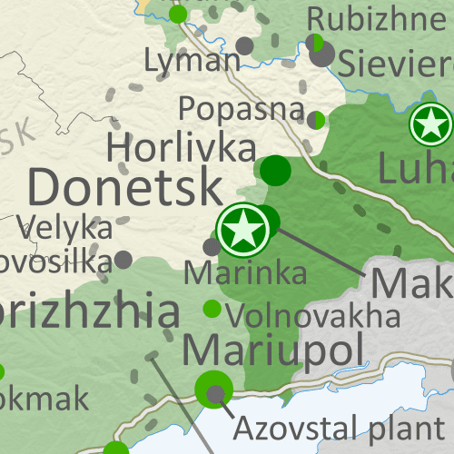
Map of territorial control and frontlines in the Donbass region of Donetsk and Luhansk, internationally recognized as part of eastern Ukraine but partly controlled by the breakaway Donetsk People's Republic and Lugansk People's Republic. Updated for September 2020, with Minsk ceasefire lines shown. Colorblind accessible.
Areas controlled by the self-proclaimed Donetsk and Lugansk People's Republics just before the Russia's full-scale invasion of Ukraine began. For approximate changes that have happened since, check out our Ukraine control map. (Map by Evan Centanni and Djordje Djukic. Contact us for permission to use this map.)

Donetsk and Lugansk: Unrecognized "Republics"

Though now overshadowed by the war, an important political geography event took place in the days leading up to Russia's invasion of Ukraine, changing some versions of the world's list of countries.

Back in April 2014, the month after Russia-backed separatists in the peninsula of Crimea declared their independence from Ukraine, Russia-backed rebels in Ukraine's eastern provinces of Donetsk and Luhansk also announced that they were forming independent countries: the Donetsk People's Republic (DPR) and Lugansk People's Republic (LPR). ("Luhansk" is the Ukrainian-language spelling of the place name, while "Lugansk" is the Russian-language version.)

But unlike Crimea, which had already been secured by Russia's military, and was quickly absorbed into Russia with the permission of its supposed independent government, Donetsk and Lugansk would remain unrecognized for the next eight years - not officially treated as independent countries by any other country, even Russia.*

Friday, March 25, 2022

Ukraine: Map of Russian Control on March 24, 2022 (Subscription)

SUBSCRIBERS CLICK HERE TO PROCEED TO ARTICLE AND MAP

There are newer versions of this map available. To see them, view all Ukraine articles on PolGeoNow.

Research by Djordje Djukic. Map by Evan Centanni and Djordje Djukic

Subscribe for full access to all conflict map reports!

Map of Russian-controlled territory in Ukraine one month into the Russian invasion (March 24, 2022). In addition to the Crimean peninsula, which Russia had already seized in 2014, and parts of the far eastern Donetsk and Luhansk provinces (the Donbass region) already controlled by Russia-backed separatist rebels (and declared independent as the Donetsk and Lugansk People's Republics), Russian forces have moved into large areas of the countryside north of Ukrainian capital city Kyiv (Kiev), along a wide swath of the northeastern border from Kyiv to the country's eastern end, and in a growing strip of territory just north of Crimea, including Kherson city and parts of Mariupol, while also expanding control somewhat in Donetsk and much more in Luhansk, covering most of that province. Map includes key locations from the news, such as Irpin, Izium (Izyum), Rubizhne, Baryshivka, Makariv, and many more. Colorblind accessible. One month into the Russian invasion of Ukraine, forces of the Ukrainian government have managed to recapture some ground from Russia. However, Russian troops have made smaller, but still significant, advances along other fronts, such as within the port city of Mariupol.

See all this and more on the latest update to PolGeoNow's concise, professional Ukraine war control map, which includes a timeline of changes since our previous Ukraine map report of March 15, with sources cited.

This map and report are premium content, available to paid subscribers of the PolGeoNow Conflict Mapping Service.

Want to see before you subscribe? Check out our most recent FREE SAMPLE Ukraine map!

Exclusive map report includes:

  • Up-to-date illustration of current territorial control in Ukraine, color-coded for the Ukrainian government on one side and the Russian military and allied rebels on the other side, with areas of uncertainty indicated. Colorblind accessible.
  • Darker color indicating which areas were already under Russian or allied control before the 2022 invasion began
  • Claimed borders of the Russia-backed, self-proclaimed Donetsk People's Republic and Lugansk People's Republic in the eastern Donbass region.
  • Detailed indication of city-by-city control, including key towns and other locations important to current events
  • Locations of recent control changes and other important events, including Irpin, Izium (Izyum), Rubizhne, Baryshivka, Makariv, and more
  • Detailed timeline of important events and changes to territorial control since March 15, 2022, with links to sources.

SUBSCRIBERS CLICK HERE TO PROCEED TO ARTICLE AND MAP

Not signed up yet? Click here to learn more about our professional subscription service!

Can I purchase just this map?
This map and report are not available for automated purchase to non-subscribers. If you need access or republication rights for only this map report, contact service@polgeonow.com for options.

Wednesday, March 16, 2022

Ukraine: Map of Russian Control on March 15, 2022 (Subscription)

SUBSCRIBERS CLICK HERE TO PROCEED TO ARTICLE AND MAPHidden image for crawlers

There are newer versions of this map available. To see them, view all Ukraine articles on PolGeoNow.


Research by Djordje Djukic. Map by Evan Centanni and Djordje Djukic

Subscribe for full access to all conflict map reports!

Thumbnail preview of map of Russian-controlled territory in Ukraine during the third week of the Russian invasion (March 15, 2022). In addition to the Crimean peninsula, which Russia had already seized in 2014, and parts of the far eastern Donetsk and Luhansk provinces (the Donbass region) already controlled by Russia-backed separatist rebels (and declared independent as the Donetsk and Lugansk People's Republics), Russian forces have moved into large areas of the countryside north of Ukrainian capital city Kyiv (Kiev), along a wide swath of the northeastern border from Kyiv to the country's eastern end, and in a growing strip of territory just north of Crimea, including Kherson city and parts of Mariupol, while also expanding control somewhat in Donetsk and much more in Luhansk, covering most of that province. Full map includes key locations from the news, such as Irpin, Izium (Izyum), Skadovsk, Mariupol, Brovary, Voznesensk, the military base near the Polish border that was hit by Russian airstrikes, and many more. Colorblind accessible. The invasion of Ukraine is still proceeding slowly in its third week. While Russian and allied rebels have filled many gaps in their control around the country's edges, they've made only small progress towards capturing any more cities. Meanwhile, most of Ukraine's interior and western half remain under Ukrainian government control.

See all this and more on the latest update to PolGeoNow's concise, professional Ukraine war control map, which includes a timeline of changes since our previous Ukraine map report of March 6, with sources cited.

This map and report are premium content, available to paid subscribers of the PolGeoNow Conflict Mapping Service.

Want to see before you subscribe? Check out our most recent FREE SAMPLE Ukraine map!

Exclusive map report includes:

  • Up-to-date illustration of current territorial control in Ukraine, color-coded for the Ukrainian government on one side and the Russian military and allied rebels on the other side, with areas of uncertainty indicated. Colorblind accessible.
  • Darker color indicating which areas were already under Russian or allied control before the 2022 invasion began
  • Claimed borders of the Russia-backed, self-proclaimed Donetsk People's Republic and Lugansk People's Republic in the eastern Donbass region.
  • Detailed indication of city-by-city control, including key towns and other locations important to current events
  • Locations of recent control changes and other important events, including Irpin, Izium (Izyum), Skadovsk, Mariupol, Brovary, Voznesensk, Yavoriv military base, and more
  • Detailed timeline of important events and changes to territorial control since March 6, 2022, with links to sources.

SUBSCRIBERS CLICK HERE TO PROCEED TO ARTICLE AND MAP

Not signed up yet? Click here to learn more about our professional subscription service!

Can I purchase just this map?
This map and report are not available for automated purchase to non-subscribers. If you need access or republication rights for only this map report, contact service@polgeonow.com for options.
Monday, March 7, 2022

Ukraine: Map of Russian Control on March 6, 2022

There are newer versions of this map available. To see them, view all Ukraine articles on PolGeoNow.
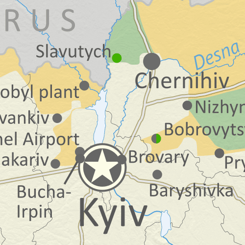
Map of Russian-controlled territory in Ukraine during the second week of the Russian invasion (March 6, 2022). In addition to the Crimean peninsula, which Russia had already seized in 2014, and parts of the far eastern Donetsk and Luhansk provinces (the Donbass region) already controlled by Russia-backed separatist rebels (and declared independent as the Donetsk and Lugansk People's Republics), Russian forces have moved into large areas of the countryside north of Ukrainian capital city Kyiv (Kiev), along a long slowly-growing swath of the northeastern border adjacent to Kharkiv city, and in a growing chunk of territory just north of Crimea, including Kherson city and parts of Mariupol, while also expanding control somewhat in Donetsk and much more in Luhansk, covering most of that province. Map includes key locations from the news, such as Kherson, the Zaporizhzhia nuclear power plant, Volnovakha, Kharkiv, Romny, Mykolaiv, Bobrovytsya, and more. Colorblind accessible.
Map by Evan Centanni and Djordje Djukic. Contact us for permission to use this map.

(Subscribers click here to view this article in the member area)

Timeline by Djordje Djukic

Ukraine Map: Russian Troops Gradually Advancing

In the week since our previous Ukraine control map report, Russia and allied rebels have continued expanding their control at a modest pace, seizing the small city of Kherson in the south, expanding separatist control to cover most of Luhansk province, and bringing the port city of Mariupol under siege. Kherson, though the largest city yet captured since the full-scale invasion began on February 24, isn't the biggest city taken from Ukraine by Russia overall, since the slightly larger Sevastopol and Simferopol in Crimea have been controlled by Russia since 2014 (meanwhile, the much larger city of Donetsk, as well as somewhat larger Luhansk, have also been controlled by pro-Russian rebels since that time).

Monday, February 28, 2022

Ukraine: Map of Russian Control on Feb. 27, 2022

There are newer versions of this map available. To see them, view all Ukraine articles on PolGeoNow.
Map of Russian-controlled territory in Ukraine at the end of the fourth day of the Russian invasion (February 27, 2022). In addition to the Crimean peninsula, which Russia had already seized in 2014, and parts of the far eastern Donetsk and Luhansk provinces (the Donbass region) already controlled by Russia-backed separatist rebels (and declared independent as the Donetsk and Lugansk People's Republics), Russian forces have moved into large areas of the countryside north of Ukrainian capital city Kyiv (Kiev), along a long swath of the northeastern border adjacent to Kharkiv city, and in a robust chunk of territory just north of Crimea, while also expanding control a small amount in Donetsk and a larger amount in Luhansk. Map includes key locations from the news, such as Melitopol, Chernobyl, Hostomel Airport, Konotop, Kupiansk, Tokmak, Vasylkiv, Ivankiv, and the Kakhovka Reservoir. Colorblind accessible.
Map by Evan Centanni and Djordje Djukic. Contact us for permission to use this map.

(Subscribers click here to view this article in the member area)

Timeline by Djordje Djukic, with additional reporting by Evan Centanni

Russian Invasion Map: Ukraine at War

Months of US warnings that Russia was planning to invade Ukraine were proven right last Thursday, as Russian troops, tanks, ships, and aircraft flooded into the neighboring country. Russia had already taken over Ukraine's southern province of Crimea in 2014, and pro-Russia separatists claimed to have split off from eastern Ukraine after seizing much of Donetsk and Luhansk provinces. But Russia's full-scale invasion of Ukraine is a massive new escalation, unprecedented in Europe since World War II.

The above map shows control lines as of Sunday night - just before the first round of ceasefire talks - when Russian forces had captured significant chunks of rural Ukraine, but so far not gained control of any major cities (the situation a day later remains mostly unchanged). The map is based on reporting from various news media on the status of cities and towns, with lines of control in the countryside estimated with the help of other conflict-tracking websites and social media accounts.

Saturday, December 4, 2021

Queen Elizabeth's 15 Countries: The Commonwealth Realms

Did you know Elizabeth II isn't just the Queen of England and the larger UK, but of 14 other independent countries? If that statement just raises more questions for you, read on for all the answers...

Map countries with Queen Elizabeth II as head of state, which are known as the Commonwealth realms. Includes the UK, Canada, Australia, and a number of small countries in Oceania and the Caribbean. Also shows former Commonwealth realms, including large parts of Africa and South Asia. Colorblind accessible.
Map of the Commonwealth realms (independent countries that share the monarchy with Britain). Click to enlarge. Contact us for permission to use this map.


This article, originally from 2012, has been revised and updated for the abolition of Barbados's monarchy in November 2021, which reduced the number of countries Queen Elizabeth II reigns over from 16 to 15.

Which countries does Queen Elizabeth reign over?

You might be surprised to learn that Queen Elizabeth II is the official queen of 15 different independent countries. Those countries are together known as the "Commonwealth realms" - a smaller subset of the Commonwealth of Nations, which also includes many queenless republics. Every one of the 15 Commonwealth realms is considered a fully-fledged independent country and a member of the UN, despite sharing the same monarch. 

Tuesday, September 29, 2020

Ukraine War Control Map & Report: September 2020

To see other maps in this series, plus a new map of Russian control in the 2022 invasion, view all Ukraine articles on PolGeoNow.
Map of territorial control and frontlines in the Donbass region of Donetsk and Luhansk, internationally recognized as part of eastern Ukraine but partly controlled by the breakaway Donetsk People's Republic and Lugansk People's Republic. Updated for September 2020, with Minsk ceasefire lines shown. Colorblind accessible.
Map by Evan Centanni and Djordje Djukic. Contact us for permission to use this map.

(Subscribers click here to view this article in the member area)

Timeline by Djordje Djukic, with additional reporting by Evan Centanni

Donbass Frontline Map

In the four years since PolGeoNow last updated our Ukraine control map, little has changed in terms of territorial boundaries in the region of eastern Europe known as the Donbass. Forces of the Russia-backed self-proclaimed Donetsk People's Republic (DPR) and Lugansk People's Republic (LPR) still hold a large chunk of what most of the world considers Ukraine, though their plans of formally uniting into a confederation of "Novorossiya" ("New Russia") have long gone by the wayside. But as attempts at resolving the conflict peacefully grind slowly forward, fighting has continued at a low level along the frontlines, and we have made some small changes to the map where the situation has either changed or been clarified since 2016.

Wednesday, September 23, 2020

Map & Analysis: Which Countries Recognize Kosovo in 2020?

Announcing the re-launch of our Kosovo recognition updates series! PolGeoNow will now once again be providing timely reports on when countries recognize - or un-recognize - the disputed Republic of Kosovo.

Map of Kosovo recognition, indicating which states (countries) still recognize Kosovo's independence, which have withdrawn recognition, and which claims of recognition have been denied, as of September 2020, including new addition Israel. Colorblind accessible.
Click to enlarge. By Evan Centanni, modified from public domain blank world map.
Contact us for permission to use this map.

Thursday, July 16, 2020

Bulgaria and Croatia Enter Eurozone "Waiting Room" (ERM II)

This article covers the latest changes to PolGeoNow's map of which countries use the euro.

Map of the Eurozone (euro area), showing which countries use the euro as their currency. Includes members, pre-members (ERM II or ERM-2 waiting area), EU non-members using the euro, and other EU countries (color blind accessible). Updated for July 2020 with the entry of Croatia and Bulgaria into the ERM-II.
The Eurozone, European Union, and other countries using the euro.
Map by Evan Centanni, from blank map by Ssolbergj. License: CC BY-SA

Croatia and Bulgaria preparing to adopt the euro

The southeastern European countries of Bulgaria and Croatia have been approved by the European Union's central bank to take the next step towards joining the Eurozone - the organization of countries that officially use the euro as their shared currency. As new participants in the "European Exchange Rate Mechanism II" (ERM II or ERM-2), Croatia and Bulgaria are on track to adopt the euro after a 2-3 year waiting period - likely on January 1, 2024.

Which Countries Used the Euro in 2020? (Map of the Eurozone)

There's a newer version of this map and article available. You can always find the latest version at this link: Which Countries Use the Euro Today? (Map of the Eurozone)

This is the archived 2020 version of our Eurozone map and explainer article, which itself was updated from an article originally published in June 2016, with the earliest version of the map appearing in a 2014 news post.

Map of the Eurozone (euro area), showing which countries use the euro as their currency. Includes members, pre-members (ERM II or ERM-2 waiting area), EU non-members using the euro, and other EU countries (color blind accessible). Updated for July 2020 with the entry of Croatia and Bulgaria into the ERM-II.
The Eurozone, European Union, and other countries using the euro.
Map by Evan Centanni, from blank map by Ssolbergj. License: CC BY-SA

Article by Caleb Centanni, with additional content by Evan Centanni 

What is the Eurozone?

Officially called the "euro area", the Eurozone is a nickname for the group of countries in Europe that share a single currency, called the euro. The euro currency is administered by the European Union (EU), but many countries in the EU don't use the euro, and some countries outside the EU do use it. The European Central Bank, the governing financial body of the Eurozone, is headquartered in Frankfurt, Germany. Germany, along with eleven other EU countries, became a founding member of the Eurozone in 1999.

Tuesday, April 14, 2020

Schengen Border Controls in the Time of Coronavirus (April 14, 2020)

This map and article have been updated to April 14, 2020. You can also view the previous edition of the map, from March 27, with its accompanying timeline.

Since 2016, PolGeoNow has mapped reinstated border controls within Europe's Schengen free travel area, with the companion piece to this article covering changes from mid-2017 up to last month. Now, border controls between European countries have drastically expanded amid the global coronavirus pandemic. 

Read on for a country-by-country list of border controls and travel bans, plus a timeline of what went into effect when.

Schengen borders map showing temporary reintroduction of border controls in the Schengen Area (the European Union's border-free travel zone) as of April 14, 2020, during the widespread closure of internal Schengen borders due to the COVID-19 coronavirus pandemic. Also includes, in a different color, controls announced by governments where the EU has not been notified.
Map by Evan Centanni, from blank map by Ssolbergj. License: CC BY-SA
Article by Evan Centanni

Coronavirus-related Border Checks in the Schengen Area

As many travelers know, much of Europe is linked together as part of the "Schengen Area", a collection of countries that don't make travelers show any ID to cross the borders between them, and don't regulate what people bring across with them either (although this system is overseen by the European Union, the Schengen Area and the EU aren't the same thing). But under special circumstances, member countries can choose to temporarily resume border checks (also known as "border control").