Showing posts with label kurdistan. Show all posts

Saturday, January 11, 2025

Syria: Map of Control in January 2025 (Subscription)

SUBSCRIBERS CLICK HERE TO VIEW FULL ARTICLE AND MAP:
Old Portal (members.polgeonow.com) | New Portal (controlmaps.polgeonow.com)


There are newer editions of this map available. To see them, view all Syria updates.

Research by Djordje Djukic. Map by onestopmap.com, Evan Centanni, and Djordje Djukic
Subscribe for full access to all conflict map reports!

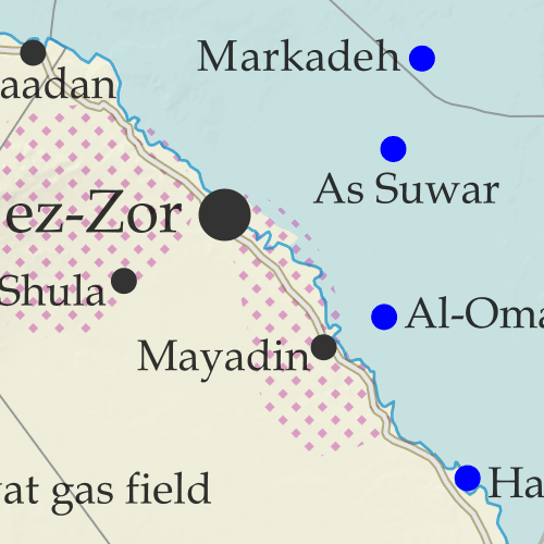
Thumbnail preview of Syrian Civil War map: Territorial control in Syria on January 9, 2025, a month after the collapse of the Assad government (Hayat Tahrir al-Sham (HTS / Al-Nusra Front), Free Syrian Army and Syrian National Army rebels backed by Türkiye (Turkey), Kurdish YPG, Syrian Democratic Forces (SDF), Israeli military (IDF), remaining Russian bases, and area controlled by Druze militias of uncertain alignment). Includes areas of major known activity for so-called Islamic State (ISIS/ISIL), Turkish presence, and US deconfliction zone, plus recent locations of conflict and other events, including Dayr Hafir (Deir Hafir), the Tishrin Dam, Suwayda, Hmeimim (Khmeimim) airbase, Russia's Tartus naval base, and more.A month after the fall of Assad, much is still unresolved. Russian bases remain along the coast, and Kurdish-led forces operate their own government in the east, where their war with Turkish-backed former rebels continues after a failed ceasefire. 

Meanwhile, Israel has further expanded its control in the southwest, while the so-called "Islamic State" (ISIS/ISIL) reportedly grows in power, and Suwayda province is controlled by Druze militias with an unclear stance towards the new rebel-installed national government.

See all this and more on the latest update to PolGeoNow's concise, professional Syrian Civil War control map, which includes a timeline of key events since our previous Syria map report illustrating the situation on December 14, with sources cited.

This map and report are premium content, available to paid subscribers of the PolGeoNow Conflict Mapping Service.

Want to see before you subscribe? Check out our most recent FREE SAMPLE Syria map!

Exclusive map report includes:

  • Up-to-date illustration of current territorial control in Syria, color-coded for the victorious rebel coalition, the Kurdish-led Syrian Democratic Forces (SDF), resurgent forces of the so-called "Islamic State" (ISIS/ISIL), the Israeli military (IDF), and other non-rebel-allied forces like the Russian military and Druze militias.
  • Pattern showing the major areas of "Islamic State" (ISIS/ISIL) activity beyond what the group fully controls.
  • Special symbol for joint Turkish/rebel control and in the border region
  • Outline showing approximate location of the US-declared "deconfliction zone"
  • Special symbols indicating which towns and cities are under the rebel bloc led by Hayat Tahrir al-Sham (HTS) - formerly the Al Qaeda-affiliated Nusra Front - and by the Kurdish YPG militia (part of the SDF anti-"Islamic State" coalition)
  • Detailed indication of city-by-city control, including key towns and other locations important to current events
  • Locations of recent control changes and other important events, including Dayr Hafir, the Tishrin Dam, Suwayda, Hmeimim (Khmeimim) airbase, Russia's Tartus naval base, and more
  • Detailed timeline of important events and changes to territorial control since December 14, 2024, with links to sources.

SUBSCRIBERS CLICK HERE TO VIEW FULL ARTICLE AND MAP:
Old Portal (members.polgeonow.com) | New Portal (controlmaps.polgeonow.com)


Not signed up yet? Click here to learn more about our professional subscription service!

Can I purchase just this map?
This map and report are not available for automated purchase to non-subscribers. If you need access or republication rights for only this map report, contact service@polgeonow.com for options.

Friday, December 20, 2024

Syria: Map of Control After the Fall of Assad - Dec. 14, 2024 (Subscription)

SUBSCRIBERS CLICK HERE TO VIEW FULL ARTICLE AND MAP:
Old Portal (members.polgeonow.com) | New Portal (controlmaps.polgeonow.com)


There are newer editions of this map available. To see them, view all Syria updates.

Research by Djordje Djukic, with additional reporting by Evan Centanni. Map by onestopmap.com, Evan Centanni, and Djordje Djukic

Subscribe for full access to all conflict map reports!

Thumbnail preview of Syrian Civil War map: Territorial control in Syria on December 14, 2024, almost a week after the final collapse of the Assad government (Hayat Tahrir al-Sham (HTS / Al-Nusra Front), Free Syrian Army and Syrian National Army rebels backed by Türkiye (Turkey), Kurdish YPG, Syrian Democratic Forces (SDF), Israeli military (IDF), and remaining Russian bases). Includes areas of major known activity for so-called Islamic State (ISIS/ISIL), Turkish presence, and US deconfliction zone, plus recent locations of conflict and other events, including Manbij, Tanf, Al-Kawm, Hmeimim (Khmeimim) airbase, Russia's Tartus naval base, Al-Ba'ath, and more.As the Syrian government collapsed, rebel forces spread out to assert themselves as the new authorities across most of the country, though much remains to be settled. Turkish-backed rebels jockeyed with the Kurdish-led SDF for control of the north and east, while Israel sent troops towards Damascus and the so-called "Islamic State" (ISIS/ISIL) attempted a resurgence in the central desert.

See all this and more on the latest update to PolGeoNow's concise, professional Syrian Civil War control map, which includes a timeline of key events since our previous Syria map report illustrating the situation eight days earlier, with sources cited.

This map and report are premium content, available to paid subscribers of the PolGeoNow Conflict Mapping Service.

Want to see before you subscribe? Check out our most recent FREE SAMPLE Syria map!

Exclusive map report includes:

  • Up-to-date illustration of current territorial control in Syria, color-coded for the victorious rebel coalition, the Kurdish-led Syrian Democratic Forces (SDF), resurgent forces of the so-called "Islamic State" (ISIS/ISIL), the Israeli military, and the two remaining Russian military bases in the country.
  • Pattern showing the major areas of "Islamic State" (ISIS/ISIL) activity beyond what the group fully controls.
  • Special symbol for joint Turkish/rebel control and in the border region
  • Outline showing approximate location of the US-declared "deconfliction zone"
  • Special symbols indicating towns dominated by the rebels of Hayat Tahrir al-Sham (HTS) - formerly the Al Qaeda-affiliated Nusra Front - and by the Kurdish YPG militia (part of the SDF anti-"Islamic State" coalition)
  • Detailed indication of city-by-city control, including key towns and other locations important to current events
  • Locations of recent control changes and other important events, including Manbij, Tanf, Al Kawm, Hmeimim (Khmeimim) airbase, Russia's Tartus naval base, Al-Ba'ath, and more
  • Detailed timeline of important events and changes to territorial control since December 6, 2024, with links to sources.

SUBSCRIBERS CLICK HERE TO VIEW FULL ARTICLE AND MAP:
Old Portal (members.polgeonow.com) | New Portal (controlmaps.polgeonow.com)


Not signed up yet? Click here to learn more about our professional subscription service!

Can I purchase just this map?
This map and report are not available for automated purchase to non-subscribers. If you need access or republication rights for only this map report, contact service@polgeonow.com for options.

Monday, December 9, 2024

Syrian Civil War Reignites: Map of Control Amid Rebel Advance (Dec. 6, 2024)

This map shows the situation on December 6, 2024, just before the final collapse of the Bashar al-Assad government in Damascus. Though the cities of Homs and Damascus have reportedly come under rebel control since then, the country is now in such disarray that current control can't be accurately mapped. 

We plan to publish an update for our subscribers within the next few days, clarifying post-Assad control once the dust has begun to settle.

There are newer editions of this map available. To see them, view all Syria updates.

Syrian Civil War map: Territorial control in Syria on December 6, 2024, ten days into the surprise rebel offensive, and just before their advance led to a full collapse of the Assad government (Free Syrian Army rebels, Kurdish YPG, Syrian Democratic Forces (SDF), Hayat Tahrir al-Sham (HTS / Al-Nusra Front), and others). Includes areas of major known activity for so-called Islamic State (ISIS/ISIL), Turkish/SNA control, joint SDF-Assad control, and US deconfliction zone, plus recent locations of conflict, including Aleppo, Hama, Daraa, Deir ez-Zor, and more. Colorblind accessible.
Base map by Koen Adams of onestopmap.com, with territorial control by Djordje Djukic and Evan Centanni. Area of IS activity is based on 2024 data from ACLED (see footnote for full citation), and reflects a change in methodology from previous editions.
Contact us for permission to use this map.

Timeline by Djordje Djukic

Return to War: Lightning Offensive and Countrywide Shifts

Twelve days ago, Syria's 13-year-old civil war, mostly dormant for the past four years, exploded back onto the scene with a surprise rebel offensive out of the northwest, which quickly managed to seize the country's second largest city, Aleppo. The lead rebel group was the former Al Qaeda affiliate Hayat Tahrir al-Sham (HTS), though Turkish-backed rebels from the northern border regions also joined the fray, with the two groups quickly taking over the country's second largest city, Aleppo. 

As hardline HTS-led forces marched rapidly south, two more rebel fronts emerged, with US-backed fighters in the southern desert expanding out of their longtime safe zone, and a reborn opposition in the southwest recapturing the former rebel stronghold of Daraa. Meanwhile, the Kurdish-led Syrian Democratic Forces (SDF) moved to consolidate their control in the north and east, and over the next ten days moved into areas west of the Euphrates River - including the major city of Deir ez-Zor - as the Syrian military withdrew.

December 6th - the date illustrated on the map above - saw the Syrian military's last major resistance to the surprise rebel assault. The next two days would be a period of government free fall, with rebels apparently entering the city of Homs and national capital Damascus without much resistance. Meanwhile, authoritarian president Bashar al-Assad fled the country as his military withdrew from both cities and the country's central desert, conceding victory in the central conflict of the country's 13-year civil war.

Assad Has Fallen: What's Next for Control in Syria?

Syria is now in disarray, and many questions remain to be answered. What kind of new government will emerge in Damascus? Will former government loyalists hold onto the country's now-isolated coastal region, a traditional bastion of Assad's supporters and still host to his Russian military allies? Will democracy-minded rebel groups work together with the religious-hardline HTS, turn against it, or go their own way in their own strongholds? 

One thing that does seem certain: Syria's division isn't over yet. Even if a rebel coalition government secures power over the country's whole west and center, much of the north and northeast remain under control of the Kurdish-led SDF. While the SDF and the provisional government of its controlled areas do still consider themselves part of Syria, they'll likely be in no hurry to submit to any rebel-led administration. For one thing, they're determined to guarantee rights for Syria's Kurdish people before any future reintegration - and likely under pressure from its US patrons to continue the fight against the so-called "Islamic State" (IS, formerly ISIS).

But the Kurdish-led forces in the northeast also aren't on good terms with either of the two most powerful rebel factions. With Türkiye's government labeling the Kurdish militias at the core of the SDF's forces as terrorist groups, Turkish-backed rebels are more enemies than friends to the US-backed coalition (despite the US and Türkiye being allied with each other as fellow NATO members). Meanwhile, it probably goes without saying that the pro-democracy, fiercely anti-IS, US-supported SDF will be wary of cooperation with the religious-hardline HTS, who many fear could become the next Taliban.

To follow our further coverage as post-Assad territorial control develops, visit or bookmark our listing of all Syria control map reports.

Friday, July 21, 2023

Syria Control Map & Report - July 2023 (Subscription)

SUBSCRIBERS CLICK HERE TO VIEW FULL ARTICLE AND MAP:
Old Portal (members.polgeonow.com) | New Portal (controlmaps.polgeonow.com)


There are newer editions of this map available. To see them, view all Syria updates.

Research by Djordje Djukic. Map by onestopmap.com, Evan Centanni, and Djordje Djukic

Subscribe for full access to all conflict map reports!

Thumbnail preview of Syrian Civil War map: Territorial control in Syria in July 2023 (Free Syrian Army rebels, Kurdish YPG, Syrian Democratic Forces (SDF), Hayat Tahrir al-Sham (HTS / Al-Nusra Front), and others). Includes areas of dispersed operational presence for so-called Islamic State (ISIS/ISIL), Turkish/TFSA control, joint SDF-Assad control, US deconfliction zone, and Turkey-Russia security corridor, plus recent locations of conflict, including Afrin, Tanf, Al-Kawm, and more. Colorblind accessible.For years there have been no lasting changes to the lines of control in Syria's nearly-frozen civil war, but sporadic fighting has continued between rival rebel groups, between Turkish-led forces and elements of the Kurdish-led Syrian Democratic Forces (SDF), and as part of the ongoing insurgency carried out by the so-called "Islamic State" (IS; formerly ISIS/ISIL).

See all this and more on the latest update to PolGeoNow's concise, professional Syrian Civil War control map, which includes a timeline of key events since our previous Syria map report from last year, with sources cited.

This map and report are premium content, available to paid subscribers of the PolGeoNow Conflict Mapping Service.

Want to see before you subscribe? Check out our most recent FREE SAMPLE Syria map!

Exclusive map report includes:

  • Up-to-date illustration of current territorial control in Syria, color-coded for the Assad government, rebel groups, and the Kurdish-led Syrian Democratic Forces (SDF). Colorblind accessible.
  • Pattern showing areas of "Islamic State" (ISIS/ISIL) dispersed operational presence now that the group has lost its last firmly-held territory.
  • Special symbols for joint Turkish/rebel control and joint SDF/government control in the border region
  • Extent of "security corridor" sponsored by Turkey and Russia in the rebel-held northwest
  • Outline showing approximate location of the one publicly-known US "deconfliction zone"
  • Special symbols indicating towns dominated by rebels of the former Al Qaeda-affiliated Nusra Front (now Hayat Tahrir al-Sham or HTS) and by the Kurdish YPG militia (part of the SDF anti-"Islamic State" coalition)
  • Detailed indication of city-by-city control, including key towns and other locations important to current events
  • Locations of recent control changes and other important events, including Afrin, Tanf, Al-Kawm, and more
  • Detailed timeline of important events and changes to territorial control since February 23, 2022, compiled by our Syria-Iraq expert, with links to sources.

SUBSCRIBERS CLICK HERE TO VIEW FULL ARTICLE AND MAP:
Old Portal (members.polgeonow.com) | New Portal (controlmaps.polgeonow.com)


Not signed up yet? Click here to learn more about our professional subscription service!

Can I purchase just this map?
This map and report are not available for automated purchase to non-subscribers. If you need access or republication rights for only this map report, contact service@polgeonow.com for options.

Thursday, February 24, 2022

Syria Control Map & Report - February 2022 (Subscription)

SUBSCRIBERS CLICK HERE TO PROCEED TO ARTICLE AND MAP

There are newer editions of this map available. To see them, view all Syria updates.

Research by Djordje Djukic. Map by onestopmap.com, Evan Centanni, and Djordje Djukic

Subscribe for full access to all conflict map reports!

Thumbnail preview of Syrian Civil War map: Full map shows territorial control in Syria in February 2022 (Free Syrian Army rebels, Kurdish YPG, Syrian Democratic Forces (SDF), Hayat Tahrir al-Sham (HTS / Al-Nusra Front), and others). Includes areas of dispersed operational presence for so-called Islamic State (ISIS/ISIL), Turkish/TFSA control, joint SDF-Assad control, US deconfliction zone, and Turkey-Russia security corridor, plus recent locations of conflict and territorial control changes, including Tafas, Atmah, Ithriya (Athriyah), Ayn Issa and more. Colorblind accessible. Despite no changes to Syria's lines of control since 2020, the so-called "Islamic State" (ISIS/ISIL) has continued a bloody insurgency in the central desert, which has increasingly occupied the Assad government and its Russian and Iranian allies. Meanwhile, fighting between Kurdish- and Turkish-led forces has carried on sporadically, and a sort of rebel resurgence in the southwest has come and gone.

See all this and more on the latest update to PolGeoNow's concise, professional Syrian Civil War control map, which includes a timeline of changes since our previous Syria map report last November, with sources cited.

This map and report are premium content, available to paid subscribers of the PolGeoNow Conflict Mapping Service.

Want to see before you subscribe? Check out our most recent FREE SAMPLE Syria map!

Exclusive map report includes:
  • Up-to-date illustration of current territorial control in Syria, color-coded for the Assad government, rebel groups, and the Kurdish-led Syrian Democratic Forces (SDF). Colorblind accessible.
  • Pattern showing areas of "Islamic State" (ISIS/ISIL) dispersed operational presence now that the group has lost its last firmly-held territory.
  • Special symbols for joint Turkish/rebel control and joint SDF/government control in the border region
  • Extent of "security corridor" sponsored by Turkey and Russia in the rebel-held northwest
  • Outline showing approximate location of the one publicly-known US "deconfliction zone"
  • Special symbols indicating towns dominated by rebels of the former Al Qaeda Nusra Front (now Hayat Tahrir al-Sham or HTS) and by the Kurdish YPG militia (part of the SDF anti-"Islamic State" coalition)
  • Detailed indication of city-by-city control, including key towns and other locations important to current events
  • Locations of recent control changes and other important events, including Tafas, Ayn Issa, Resafa, Atmah, and more
  • Detailed timeline of important events and changes to territorial control since November 22, 2020, compiled by our Syria-Iraq expert, with links to sources.

SUBSCRIBERS CLICK HERE TO PROCEED TO ARTICLE AND MAP

Not signed up yet? Click here to learn more about our professional subscription service!

Can I purchase just this map?
This map and report are not available for automated purchase to non-subscribers. If you need access or republication rights for only this map report, contact service@polgeonow.com for options.
Monday, November 23, 2020

Syria Control Map & Report: Army Takes Last IS Stronghold - November 2020 (Subscription)

SUBSCRIBERS CLICK HERE TO PROCEED TO ARTICLE AND MAP

There are newer editions of this map available. To see them, view all Syria updates.

Research by Djordje Djukic. Map by onestopmap.com, Evan Centanni, and Djordje Djukic

Subscribe for full access to all conflict map reports!

Syrian Civil War map: Territorial control in Syria in late November 2020 (Free Syrian Army rebels, Kurdish YPG, Syrian Democratic Forces (SDF), Hayat Tahrir al-Sham (HTS / Al-Nusra Front), and others). Includes areas of dispersed operational presence for so-called Islamic State (ISIS/ISIL), Turkish/TFSA control, joint SDF-Assad control, US deconfliction zone, and Turkey-Russia security corridor, plus recent locations of conflict and territorial control changes, including Doubayat gas field, Al Karak, Morek, and more. Colorblind accessible. The so-called "Islamic State" (ISIS/ISIL) has lost control of a remote gas field that formed its last clearly-held territory in Syria. But it hasn't disappeared: The group has continued carrying out attacks in the central desert through a dispersed, mobile operations network.

See all this and more on the latest update to PolGeoNow's concise, professional Syrian Civil War control map, which includes a timeline of changes since our previous Syria map report in July, with sources cited.

This map and report are premium content, available to paid subscribers of the PolGeoNow Conflict Mapping Service.

Want to see before you subscribe? Check out our most recent FREE SAMPLE Syria map!

Exclusive map report includes:
  • Up-to-date illustration of current territorial control in Syria, color-coded for the Assad government, rebel groups, and the Kurdish-led Syrian Democratic Forces (SDF). Colorblind accessible.
  • NEW: Pattern showing areas of "Islamic State" (ISIS/ISIL) dispersed operational presence now that the group has lost its last firmly-held territory.
  • Special symbols for joint Turkish/rebel control and joint SDF/government control in the border region
  • Extent of "security corridor" sponsored by Turkey and Russia in the rebel-held northwest
  • Outline showing approximate location of the one publicly-known US "deconfliction zone"
  • Special symbols indicating towns dominated by rebels of the former Al Qaeda Nusra Front (now Hayat Tahrir al-Sham or HTS) and by the Kurdish YPG militia (part of the SDF anti-"Islamic State" coalition)
  • Detailed indication of city-by-city control, including key towns and other locations important to current events
  • Locations of recent control changes and other important events, including Doubayat gas field, Al Karak, Morek, and more
  • Detailed timeline of important events and changes to territorial control since July 30, 2020, compiled by our Syria-Iraq expert, with links to sources.

SUBSCRIBERS CLICK HERE TO PROCEED TO ARTICLE AND MAP

Not signed up yet? Click here to learn more about our professional subscription service!

Can I purchase just this map?
This map and report are not available for automated purchase to non-subscribers. If you need access or republication rights for only this map report, contact service@polgeonow.com for options.

Saturday, August 22, 2020

Iraq Control Map & Timeline: Turkey Expands Control in North - August 2020 (Subscription)

SUBSCRIBERS CLICK HERE TO PROCEED TO ARTICLE AND MAP

(To see other maps in this series, view all Iraq articles.)

Research by Djordje Djukic. Map by onestopmap.com, Evan Centanni, and Djordje Djukic

Subscribe for full access to all conflict map reports!

Iraq Control Map 2020, updated to August 21. Shows areas of Iraq under Turkey's military contro, ISIS control (Islamic State/ISIL/Daesh), and under the control of the Baghdad government, the Kurdistan Peshmerga, and the Yezidi Sinjar Alliance (YBS and YJE). Marks Khamtir and Halukah Mountains (Jabal Khamtir and Jabal Halukah), controlled by Turkish forces. Colorblind accessible.
While Iraq's lines of control have mostly stayed the same since the beginning of the year, Turkey's military has been gradually increasing its control of the north. The incursion is part of the Turkish war against the Kurdish PKK, a rebel group from Turkey that now bases itself across the border in Iraq.

See all this and more on the latest update to PolGeoNow's concise, professional map of control in Iraq, including a timeline of changes since our previous Iraq map report of January 2020.

This map and report are premium content, available to paid subscribers of the PolGeoNow Conflict Mapping Service.

Want to see before you subscribe? Check out our most recent FREE SAMPLE Iraq map report!

Exclusive report includes:
  • Up-to-date map of current territorial control in Iraq, color-coded for the Iraqi government, "Islamic State" (ISIS/ISIL) fighters, Kurdistan's Peshmerga forces, and Yezidi militias. Colorblind accessible.
  • NEW: Turkish military control along the northern border, including key sites Mt. Khamtir (Jabal Khamtir) and Mt. Halukah (Jabal Halukah).
  • Detailed indication of town-by-town control, including all major cities and many smaller ones, as well as terrain, major roads, and provincial boundaries
  • Timeline of changes to the situation and related events since January, compiled by our Iraq-Syria specialist, with links to sources.
SUBSCRIBERS CLICK HERE TO PROCEED TO ARTICLE AND MAP

Not signed up yet? Click here to learn more about our professional subscription service!

Can I purchase just this map?
This map and report are not available for automated purchase to non-subscribers. If you need access or republication rights for only this map report, contact service@polgeonow.com for options.

Friday, July 31, 2020

Syria Control Map & Report: Frontlines Stable - July 2020

There are newer versions of this map available. To see them, view all Syria updates.

This is a free edition of our Syria control map series. If you want access to our full collection of Syria maps, you can sign up for our conflict map subscription service. 

Syrian Civil War map: Territorial control in Syria in late July 2020 (Free Syrian Army rebels, Kurdish YPG, Syrian Democratic Forces (SDF), Hayat Tahrir al-Sham (HTS / Al-Nusra Front), Islamic State (ISIS/ISIL), and others). Includes Turkish/TFSA control, joint SDF-Assad control, US deconfliction zone, and Turkey-Russia security corridor, plus recent locations of conflict and territorial control changes, including Suknah, Abu Kamal, Idlib, and more. Colorblind accessible.
Base map by Koen Adams of onestopmap.com, with territorial control by Evan Centanni and Djordje Djukic.
Contact us for permission to use this map.

(Subscribers click here to view this article in the member area)

Timeline by Djordje Djukic

Syrian Civil War Update: July 2020

In the four months since our previous Syria control map report, the lines of control have almost all stayed the same, with back-and-forth fighting between the sides not resulting in lasting territorial changes. The exception is in Syria's central desert, where estimates of so-called "Islamic State" (IS; formerly ISIS/ISIL) control have shrunk to include only the area surrounding the Doubayat Gas Field. Meanwhile, joint Russian-Turkish patrols have begun along the Idlib "security corridor", and Israeli airstrikes against Iranian and Hezbollah forces have become common.

Sunday, March 22, 2020

Syrian Civil War Map & Timeline: New Ceasefire Lines in Northwest - March 2020 (Subscription)

SUBSCRIBERS CLICK HERE TO PROCEED TO ARTICLE AND MAP

There are newer versions of this map available. To see them, view all Syria updates.

Research by Djordje Djukic. Map by onestopmap.com, Evan Centanni, and Djordje Djukic

Subscribe for full access to all conflict map reports!

Map of Syrian Civil War (Syria control map): Territorial control in Syria in March 2020 (Free Syrian Army rebels, Kurdish YPG, Syrian Democratic Forces (SDF), Hayat Tahrir al-Sham (HTS / Al-Nusra Front), Islamic State (ISIS/ISIL), and others). Includes Turkish/TFSA control, joint SDF-Assad control, US deconfliction zone, and Turkey-Russia security corridor, plus recent locations of conflict and territorial control changes, including Kafr Nabl, Nayrab, Anadan, Al Sanamayn, and more. Colorblind accessible. Since last month, Syria's Assad government has gained more ground against the rebels and come into direct conflict with the Turkish military. Now, a deal between Russia and Turkey has brought a new ceasefire to the area.

See all this and more on the latest update to PolGeoNow's concise, professional Syrian Civil War control map, which includes a timeline of changes since our previous Syria map report in February, with sources cited.

This map and report are premium content, available to paid subscribers of the PolGeoNow Conflict Mapping Service.

Want to see before you subscribe? Check out our most recent FREE SAMPLE Syria map!

Exclusive map report includes:
  • Up-to-date illustration of current territorial control in Syria, color-coded for the Assad government, rebel groups, "Islamic State" (ISIS/ISIL) fighters, and the Kurdish-led Syrian Democratic Forces (SDF). Colorblind accessible.
  • Special symbols for joint Turkish/rebel control and joint SDF/government control in the border region
  • Extent of "security corridor" sponsored by Turkey and Russia in the rebel-held northwest
  • Outline showing approximate location of the one publicly-known US "deconfliction zone"
  • Special symbols indicating towns dominated by rebels of the former Al Qaeda Nusra Front (now Hayat Tahrir al-Sham or HTS) and by the Kurdish YPG militia (part of the SDF anti-IS coalition)
  • Detailed indication of city-by-city control, including key towns and other locations important to current events
  • Locations of recent control changes and other important events, including Kafr Nabl, Nayrab, Anadan, Al Sanamayn, and more
  • Detailed timeline of important events and changes to territorial control since February 14, 2020, compiled by our Syria-Iraq expert, with links to sources.

SUBSCRIBERS CLICK HERE TO PROCEED TO ARTICLE AND MAP

Not signed up yet? Click here to learn more about our professional subscription service!

Can I purchase just this map?
This map and report are not available for automated purchase to non-subscribers. If you need access or republication rights for only this map report, contact service@polgeonow.com for options.

Friday, February 14, 2020

Syrian Civil War Map & Timeline: Assad Retakes Key Highway - February 2020 (Subscription)

SUBSCRIBERS CLICK HERE TO PROCEED TO ARTICLE AND MAP

There are newer versions of this map available. To see them, view all Syria updates.

Research by Djordje Djukic. Map by onestopmap.com, Evan Centanni, and Djordje Djukic

Subscribe for full access to all conflict map reports!

Map of Syrian Civil War (Syria control map): Territorial control in Syria in February 2020 (Free Syrian Army rebels, Kurdish YPG, Syrian Democratic Forces (SDF), Hayat Tahrir al-Sham (HTS / Al-Nusra Front), Islamic State (ISIS/ISIL), and others). Includes Turkish/TFSA control, joint SDF-Assad control, US deconfliction zone, and Turkey-Russia demilitarized buffer zone, plus recent locations of conflict and territorial control changes, including Marat al-Numan, Saraqeb, Regiment 46, Al-Eiss, and more. Colorblind accessible. Over the past month, forces loyal to Syria's Assad government have many major gains in the northwest, capturing two rebel strongholds and reestablishing control along the entire Damascus-Aleppo highway for the first time in eight years.

 See all this and more on the latest update to PolGeoNow's concise, professional Syrian Civil War control map, which includes a timeline of changes since our previous Syria map report in January, with sources cited.

This map and report are premium content, available to paid subscribers of the PolGeoNow Conflict Mapping Service.

Want to see before you subscribe? Check out our most recent FREE SAMPLE Syria map!

Exclusive map report includes:
  • Up-to-date illustration of current territorial control in Syria, color-coded for the Assad government, rebel groups, "Islamic State" (ISIS/ISIL) fighters, and the Kurdish-led Syrian Democratic Forces (SDF). Colorblind accessible.
  • Special symbols for joint Turkish/rebel control and joint SDF/government control in the border region
  • Extent of "buffer zone" sponsored by Turkey and Russia in the rebel-held northwest
  • Outline showing approximate location of the one publicly-known US "deconfliction zone"
  • Special symbols indicating towns dominated by rebels of the former Al Qaeda Nusra Front (now Hayat Tahrir al-Sham or HTS) and by the Kurdish YPG militia (part of the SDF anti-IS coalition)
  • Detailed indication of city-by-city control, including key towns and other locations important to current events
  • Locations of recent control changes and other important events, including Marat al-Numan, Saraqeb, the Regiment 46 base, Al-Eiss, and more
  • Detailed timeline of important events and changes to territorial control since January 20, 2020, compiled by our Syria-Iraq expert, with links to sources.

SUBSCRIBERS CLICK HERE TO PROCEED TO ARTICLE AND MAP

Not signed up yet? Click here to learn more about our professional subscription service!

Can I purchase just this map?
This map and report are not available for automated purchase to non-subscribers. If you need access or republication rights for only this map report, contact service@polgeonow.com for options.

Wednesday, January 22, 2020

Syrian Civil War Map & Timeline - January 2020 (Subscription)

SUBSCRIBERS CLICK HERE TO PROCEED TO ARTICLE AND MAP

There are newer versions of this map available. To see them, view all Syria updates.

Research by Djordje Djukic. Map by onestopmap.com, Evan Centanni, and Djordje Djukic

Subscribe for full access to all conflict map reports!

Map of Syrian Civil War (Syria control map): Territorial control in Syria in January 2020 (Free Syrian Army rebels, Kurdish YPG, Syrian Democratic Forces (SDF), Hayat Tahrir al-Sham (HTS / Al-Nusra Front), Islamic State (ISIS/ISIL), and others). Includes Turkish/TFSA control, joint SDF-Assad control, US deconfliction zone, and Turkey-Russia demilitarized buffer zone, plus recent locations of conflict and territorial control changes, including Marat al-Numan, Al-Hayl Gas Field, Abu Kamal, and more. Colorblind accessible.Since November, Syrian army forces loyal to the Bashar al-Assad government have captured more small parts of the rebel-dominated Idlib province, even as the so-called "Islamic State" (ISIS/ISIL) continues its activities in the eastern desert.

See all this and more on the latest update to PolGeoNow's concise, professional Syrian Civil War control map, which includes a timeline of changes since our previous Syria map report in November, with sources cited.

This map and report are premium content, available to paid subscribers of the PolGeoNow Conflict Mapping Service.

Want to see before you subscribe? Check out our most recent FREE SAMPLE Syria map!

Exclusive map report includes:
  • Up-to-date illustration of current territorial control in Syria, color-coded for the Assad government, rebel groups, "Islamic State" (ISIS/ISIL) fighters, and the Kurdish-led Syrian Democratic Forces (SDF). Colorblind accessible.
  • Special symbols for joint Turkish/rebel control and joint SDF/government control in the border region
  • Extent of "buffer zone" sponsored by Turkey and Russia in the rebel-held northwest
  • Outline showing approximate location of the one publicly-known US "deconfliction zone"
  • Special symbols indicating towns dominated by rebels of the former Al Qaeda Nusra Front (now Hayat Tahrir al-Sham or HTS) and by the Kurdish YPG militia (part of the SDF anti-IS coalition).
  • Detailed indication of city-by-city control, including key towns and other locations important to current events.
  • Locations of recent control changes and other important events, including Ras al-Ayn, Tel Abyad, Ayn Issa, and more.
  • Detailed timeline of important events and changes to territorial control since November 28, 2019, compiled by our Syria-Iraq expert, with links to sources. 

SUBSCRIBERS CLICK HERE TO PROCEED TO ARTICLE AND MAP

Not signed up yet? Click here to learn more about our professional subscription service!

Can I purchase just this map?
This map and report are not available for automated purchase to non-subscribers. If you need access or republication rights for only this map report, contact service@polgeonow.com for options.

Saturday, January 11, 2020

Iraq Control Map & Timeline - January 2020

There are newer versions of this map available. To see them, view all Iraq updates.

Iraq Control Map 2020, updated to January 10. Shows areas of Iraq under ISIS control (Islamic State/ISIL/Daesh), and under the control of the Baghdad government, the Kurdistan Peshmerga, and the Yezidi Sinjar Alliance (YBS and YJE). Colorblind accessible.
Basemap by Koen Adams of onestopmap.com, with territorial control by Evan Centanni and Djordje Djukic.
Contact us for permission to use this map.
(Subscribers click here to view this article in the member area)

Timeline by Djordje Djukic, with additional reporting by Evan Centanni

Iraq Map: Who Controls What in 2020

In the nearly two years since our previous Iraq control map update, there have been few major changes to the situation on the ground. But the so-called "Islamic State" (IS; formerly ISIS/ISIL) isn't gone, and recent reports say the group has begun regaining power in the country's north. Tensions have also escalated recently between the US and Iran - both countries are heavily involved in Iraq, and have long competed for influence there. Meanwhile, the self-governed Kurdistan region remains in control of the far north, despite having lost some its claimed territory to the Iraqi central government in the aftermath of its controversial 2017 independence vote.

Thursday, September 12, 2019

Syrian Civil War Map & Timeline - September 2019

There are newer versions of this map available. To see them, view all Syria updates.

Map of Syrian Civil War (Syria control map): Territorial control in Syria in September 2019 (Free Syrian Army rebels, Kurdish YPG, Syrian Democratic Forces (SDF), Hayat Tahrir al-Sham (HTS / Al-Nusra Front), Islamic State (ISIS/ISIL), and others). Includes US deconfliction zone and Turkey-Russia demilitarized buffer zone, plus recent locations of conflict and territorial control changes, including Khan Shaykhun, Kabani, Morek, and more. Colorblind accessible.
Base map by Koen Adams of onestopmap.com, with territorial control by Evan Centanni and Djordje Djukic.
Contact us for permission to use this map.
(Subscribers click here to view this article in the member area)

Timeline by Djordje Djukic

Government Captures Rebel Stronghold in Idlib

In what's been nearly a month since our previous Syria control map update, almost all major activities have been focused around the southern end of rebel-held Idlib province. For the first time, government forces have captured a major town on the rebel side of the of would-be buffer zone set up last year by Turkey and Russia. Meanwhile, possible changes loom in Syria's northeast, where Turkey is pushing the US to set up a "safe zone" to keep the Kurdish-majority YPG militia away from the border.

Friday, December 28, 2018

Syrian Civil War Map & Timeline: IS Loses Western Enclave - December 2018

There are newer versions of this map available. To see them, view all Syria updates.

Map of Syrian Civil War (Syria control map): Territorial control in Syria in December 2018, just before the US troop withdrawal (Free Syrian Army rebels, Kurdish YPG, Syrian Democratic Forces (SDF), Hayat Tahrir al-Sham (HTS / Al-Nusra Front), Islamic State (ISIS/ISIL), and others). Includes US deconfliction zone and Turkey-Russia demilitarized buffer zone, plus recent locations of conflict and territorial control changes, such as Hajin, Al Safa, Baghuz, and more. Colorblind accessible.
Base map by Koen Adams of onestopmap.com, with territorial control by Evan Centanni and Djordje Djukic.
Contact us for permission to use this map.
(Subscribers click here to view this article on the member site)

Timeline by Djordje Djukic

Syria: Where Things Stand Now

In the month and a half since our previous Syria control map report, the main territorial changes have been losses by the so-called "Islamic State" (IS; formerly ISIS/ISIL). The Assad government has eliminated the last pocket of IS control in western Syria, in the south's Al Safa area, and the Kurdish-led Syrian Democratic Forces (SDF) have recaptured the town of Hajin in the east, while also driving IS once again off of the Syria-Iraq border.

Thursday, February 15, 2018

Syrian Civil War Map & Timeline - February 2018

There are newer versions of this map available. To see them, view all Syria updates.

Who controls what in Syria? Rebel and ISIS control map of the Syrian Civil War. Shows territorial control as of February 2018 (Free Syrian Army rebels, Kurdish YPG, Syrian Democratic Forces (SDF), Jabhat Fateh al-Sham / Hayat Tahrir al-Sham (Al-Nusra Front), Islamic State (ISIS/ISIL), and others). Includes Russia-Turkey-Iran agreed de-escalation zones and US deconfliction zone, plus recent locations of conflict and territorial control changes, such as Abu al-Duhur, Bulbul, Saraqeb, and more. Colorblind accessible.
Base map by Koen Adams of onestopmap.com, with territorial control by Evan Centanni and Djordje Djukic.
Contact us for permission to use this map.
(Subscribers click here to view this article on the member site)

Timeline by Djordje Djukic

Situation Summary

The past few weeks since our previous Syria map update have been dominated by news from two main arenas of battle, both in the country's northwest. In the most politically significant development, the Turkish military has entered the Kurdish-administrated Afrin region (also spelled "Efrin") as part of a mission, alongside allied rebel fighters, to drive Kurdish militias out of the western border region. Meanwhile, forces loyal to Syria's Assad government have made major advances in areas south of Aleppo, eliminating an enclave of the so-called "Islamic State" (IS; formerly ISIS/ISIL) and cutting into rebel control around the edges of Idlib province.

Monday, October 16, 2017

Iraq Control Map & Timeline: Government Takes Kirkuk from Kurdistan - October 2017

There are newer versions of this map available. To see them, view all Iraq updates.

Detailed map of territorial control in Iraq as of October 16, 2017 after the recapture of Hawija and Tal Afar and government seizure of Kirkuk. including territory held by the so-called Islamic State (ISIS, ISIL), the Baghdad government, the Kurdistan Peshmerga, and the Yezidi Sinjar Alliance (YBS and YJE). Colorblind accessible.
Basemap by Koen Adams of onestopmap.com, with territorial control by Evan Centanni and Djordje Djukic. All rights reserved.
(Subscribers click here to view this article in the member area)

Timeline by Djordje Djukic

Summary of Events
Since our previous Iraq control map update in late July, there have been big changes to territorial control in Iraq, all involving expansions of control for the Iraqi military and its close allies (mainly police and Iran-backed militias): The so-called "Islamic State" (IS; formerly ISIS/ISIL) has been driven out of its Tal Afar and Hawija enclaves, and the disputed city of Kirkuk has been retaken from Kurdish forces in response to the controversial Kurdistan independence referendum. Iraqi government forces have also begun to chip away at the remaining swath of IS territory in the countryside of Anbar province, capturing the town of Anah on the road to the Syrian border.

Tuesday, September 26, 2017

Kurdistan Votes to Leave Iraq: What Happens Next?

This article is part of our Referendum 2017 coverage, spotlighting controversial independence votes in two of the world's autonomous regions: Kurdistan voted yesterday on independence from Iraq, and Catalonia will vote this Sunday on leaving Spain. 


Map of Iraq and Kurdistan's place within it, published in advance of the 2017 Iraqi Kurdistan independence referendum. Includes disputed territories and territorial control as of July 30, 2017. Colorblind accessible.
Residents of Iraqi Kurdistan voted Monday in a controversial referendum on whether to declare independence from Iraq, with preliminary results showing almost 92% in favor of separation. We're still waiting for (hopefully) detailed official results so we can map out how different districts voted. But in the meantime, let's answer some of the big questions:

Will Kurdistan become independent now?

The Kurdistan region's government considers this vote official and "binding", in contrast to an informal 2005 referendum, even though the Iraqi federal government in Baghdad considers it completely illegal. But it was never intended to trigger an automatic declaration of independence.

Instead, Kurdistan leader Masoud Barzani has promised to use a "YES" vote as leverage to negotiate independence with Iraqi government. So far, no date has been set for Kurdistan's declaration of independence, and it could still be years away.

Friday, September 22, 2017

Referendum 2017: Iraqi Kurdistan Map

Two of the world's autonomous regions are about to vote in controversial independence referendums. Iraqi Kurdistan decides on independence from Iraq this Monday, and on October 1 Catalonia plans to vote on leaving Spain. PolGeoNow will be covering these events with a series of articles, but in the meantime we couldn't wait to share our new Iraqi Kurdistan map with you!

Map of Iraq and Kurdistan's place within it, published in advance of the 2017 Iraqi Kurdistan independence referendum. Includes disputed territories and territorial control as of July 30, 2017. Colorblind accessible.
Graphic by Evan Centanni and Djordje Djukic, incorporating base map by Koen Adams of onestopmap.com. All rights reserved.

Iraqi Kurdistan Independence Referendum

The Kurdistan Region of Iraq (Iraqi Kurdistan for short) is just part of the traditional homeland of the Kurds, the Middle East's fourth-largest ethnic group after Arabs, Persians, and Turks.

Many Kurds also live in Turkey, Syria, and Iran. But Iraqi Kurdistan is where they have the most legal rights, governing themselves in what's internationally recognized as an autonomous region within Iraq.

But all's not well in Kurdistan-Iraq relations. Iraqi Kurds suffered through horrific violence and persecution in the 1980s and 90s, and now the region's top politician has staked his reputation on separating Kurdistan from Iraq permanently.

Thursday, June 22, 2017

Syrian Civil War Map & Timeline: Kurds Enter "Islamic State" Capital - June 2017

There are newer versions of this map available. To see them, view all Syria updates.

Map of Syrian Civil War (Syria control map): Fighting and territorial control in Syria in June 2017 (Free Syrian Army rebels, Kurdish YPG, Syrian Democratic Forces (SDF), Jabhat Fateh al-Sham / Hayat Tahrir al-Sham (Al-Nusra Front), Islamic State (ISIS/ISIL), and others). Includes Russia-Turkey-Iran agreed de-escalation zones and US deconfliction zone. Includes recent locations of conflict and territorial control changes, such as Raqqah, Maskanah, Arak, Tanf, Sabaa Biyar, Bir Qassab, and more. Colorblind accessible.
Base map by Koen Adams of onestopmap.com, with territorial control by Evan Centanni and Djordje Djukic.
All rights reserved.
(Subscribers click here to view this article in the member area.)

Timeline by Djordje Djukic

Syria: Where Things Stand Now

In the four weeks since our previous Syrian Civil War map report, the US-backed, Kurdish-led Syrian Democratic Forces (SDF) have advanced all the way into Raqqah, capital city of the so-called "Islamic State" (IS; formerly ISIS/ISIL). Meanwhile, Syrian government forces have also been pushing hard against IS, nearing Raqqah themselves, while making even more major advances in the southern desert. Clashes between rebels and government forces have also continued across Syria's south, even as the US enforces a rebel safe zone around its base in Tanf.

Wednesday, November 23, 2016

Syrian Civil War Control Map & Report: November 2016

There are newer versions of this map available. To see them, view all Syria updates.

Map of fighting and territorial control in Syria's Civil War (Free Syrian Army rebels, Kurdish YPG, Syrian Democratic Forces (SDF), Jabhat Fateh al-Sham (Al-Nusra Front), Islamic State (ISIS/ISIL), and others), updated to November 23, 2016. Now includes terrain and major roads (highways). Includes recent locations of conflict and territorial control changes, such as Al-Bab, Khan al-Shih, Tal Saman, Qabasin, and more. Colorblind accessible.
Base map by Koen Adams of onestopmap.com, with territorial control by Evan Centanni and Djordje Djukic.
All rights reserved.
(Subscribers click here to view this article in the member area.)

Timeline by Djordje Djukic, with additional reporting by Evan Centanni

Situation Summary
In the past month since our previous Syrian Civil War map update, fighting has focused largely on the ongoing battle for the city of Aleppo, where rebels control a large enclave in the east, as well as a three-way fight for control of Al-Bab, the largest town in the countryside east of Aleppo (at least, according to pre-war census figures). Held for nearly three years by the so-called "Islamic State" (IS; formerly ISIS/ISIL), Al-Bab is now the target of both the Turkish-backed Free Syrian Army (FSA) rebels and the US-backed Syrian Democratic Forces (SDF) coalition led by Kurdish militias. The SDF has also made progress toward the IS capital of Raqqah in the east, while the Syrian Army of President Bashar al-Assad is making slow progress against rebels in the west of the country.