Showing posts with label middle east. Show all posts

Sunday, October 6, 2024

Israel / Palestine: Map of Control at Start of Lebanon Incursion - Oct. 6, 2024 (Subscription)

SUBSCRIBERS CLICK HERE TO VIEW FULL ARTICLE AND MAP:
Old Portal (members.polgeonow.com) | New Portal (controlmaps.polgeonow.com)


(To see more maps in this series, view all Israel articles or Palestine articles on PolGeoNow.)

Map by Evan Centanni, timeline by Djordje Djukic with Evan Centanni

Subscribe for full access to all conflict map reports!

Thumbnail preview of map of who controlled Palestine and Israel's claimed territories on October 6, 2024, soon after the beginning of Israel's ground incursion into Lebanon. Shows both Israeli and Palestinian Authority administration (Fatah and Hamas factions indicated separately). Includes bigger West Bank map (Area A, Area B, and Area C). Map also includes Gaza Strip, Golan Heights, major cities and Israeli settlements, UN peacekeeper deployments (UNIFIL in Lebanon and UNDOF in Syria), no man's land, Golan Heights buffer zone (area of separation, AOS), and Shebaa Farms. Also shows which areas of Israel proper are under the greatest military restrictions, including the so-called Gaza Envelope and Confrontation Line zones as well as much of northern Israel. Includes all major cities and various key towns and sites from the news, like Khan Yunis, Nevatim airbase, Hatzerim and Tel Nof airbases, Jabalia, Yaroun, Adeissah, Jenin, Tulkarm, Tubas, and more, as well as the so-called Philadelphi Corridor and Netzarim Corridor in the Gaza Strip. Colorblind accessible.

What some once called the "Gaza War" is now unquestionably something much bigger, with Israel directing much of its military force instead across the Lebanon border at the Hezbollah militia, assassinating enemies across the middle east, and coming under major direct attack from Iran. Ground fighting in the Gaza Strip has eased, but Israeli airstrikes continue, and Israeli military actions have intensified in the West Bank.

See all this and more in the latest update to PolGeoNow's widely-acclaimed map of territorial administration in the Israel/Palestine area. In addition to the updated map, the report also includes a detailed chronicle of changes and events since June 27, 2024, the date illustrated by our previous Israel/Palestine control map.

This map and report are premium content, available to paid subscribers of the PolGeoNow Conflict Mapping Service.

Want to see before you subscribe? Check out our most recent FREE SAMPLE Israel/Palestine map report!

Exclusive map report includes:

  • Up-to-date illustration of current territorial control across all areas claimed by either Israel or Palestine, including Hamas and Israeli military control in the Gaza Strip (not in extreme detail), as well as UN peacekeeper deployments just outside the region
  • Closer-up inset map showing the divisions in the West Bank: Israeli military control ("Area C", including Israeli settlements), Fatah-led Palestinian jurisdiction ("Area A"), zones of shared administration ("Area B"), and the (annexed) area of Israeli civilian control in East Jerusalem
  • Lines illustrating the pre-1967 ceasefire boundaries separating Israel proper from the Palestinian-claimed Gaza Strip and West Bank, as well as the Syria-claimed Golan Heights
  • Labels for contentious areas, like the Gaza Strip, West Bank, Golan Heights, Shebaa Farms, and "no man's land"
  • Illustration of which parts of Israel proper are subject to the greatest restrictions by military decree under current war powers: the "Gaza Envelope" in the south and the "Confrontation Line" in the north, and now much of northern Israel and the Golan Heights.
  • Detailed indication of city-by-city control, including key towns and other locations important to current events, including in the West Bank contested towns across the border in Lebanon
  • Locations of recent control changes and other important events, including Khan Yunis, Nevatim airbase, Hatzerim and Tel Nof airbases, Jabalia, Yaroun, Adeissah, Jenin, Tulkarm, Tubas, and more, as well as the so-called Philadelphi Corridor and Netzarim Corridor in the Gaza Strip
  • Detailed timeline of important events and changes to territorial control since June 27, 2024, with links to sources.
  • Additional timeline entries chronicling events in all four additional fronts to the conflict: (1) the Lebanon border, where Israel and Hezbollah are engaged in cross-border strikes and now an Israeli ground incursion; (2) the West Bank, where near-daily Israeli raids on Palestinian-governed cities have have recently become more intense and destructive; (3) attacks on Western shipping in the Red Sea and Gulf of Aden near Yemen, where the US and UK have retaliated militarily against the Yemeni "Houthi" government; and (4) increasing related violence across the Middle East, including direct Iranian and Houthi attacks on Israel; Israeli airstrikes and assassinations in Lebanon, Syria, and Iran; and resumed Iran-backed militia attacks on US forces in Iraq and Syria (Fronts 3 and 4 are not illustrated on the map).

SUBSCRIBERS CLICK HERE TO VIEW FULL ARTICLE AND MAP:
Old Portal (members.polgeonow.com) | New Portal (controlmaps.polgeonow.com)


Not signed up yet? Click here to learn more about our professional subscription service!

Can I purchase just this map?
This map and report are not available for automated purchase to non-subscribers. If you need access or republication rights for only this map report, contact service@polgeonow.com for options.

Saturday, June 29, 2024

Israel / Palestine: Map of Control Amid Rafah Offensive - June 27, 2024 (Subscription)

SUBSCRIBERS CLICK HERE TO VIEW FULL ARTICLE AND MAP:
Old Portal (members.polgeonow.com) | New Portal (controlmaps.polgeonow.com)


There are newer editions of this map available. To see them, view all Israel articles or Palestine articles on PolGeoNow.

Map by Evan Centanni, timeline by Djordje Djukic with Evan Centanni

Subscribe for full access to all conflict map reports!

Thumbnail preview of map of who controlled Palestine and Israel's claimed territories on June 27, 2024, during the so-called Rafah offensive. Shows both Israeli and Palestinian Authority administration (Fatah and Hamas factions indicated separately). Includes bigger West Bank map (Area A, Area B, and Area C). Map also includes Gaza Strip, Golan Heights, major cities and Israeli settlements, UN peacekeeper deployments (UNIFIL in Lebanon and UNDOF in Syria), no man's land, Golan Heights buffer zone (area of separation, AOS), and Shebaa Farms. New edition also shows so-called Gaza Envelope and Confrontation Line zones, the areas of Israel proper are under the greatest military restrictions. Includes all major cities and various key towns and sites from the news, like Rafah, Nuseirat Refugee Camp, the US floating pier (humanitarian aid pier), Mount Meron, Hebbariye, Jenin, Tulkarm, and more. Now with improved colorblind accessibility.

Over the last four months, Israel first withdrew most its forces from the Gaza Strip, soon sent them back into certain areas, then began a scaled-down version of its long-promised Rafah offensive. Its forces now hold part of Rafah and other specific areas, while the UN says there's “no authority in most of the territory”. 

Meanwhile, related violence has continued along the Lebanon border, in the West Bank, and in the Red Sea, with broader Middle East tensions reaching a peak in mid-April with a direct exchange of fire between Israel and Iran.

See all this and more in the latest update to PolGeoNow's widely-acclaimed map of territorial administration in the Israel/Palestine area. In addition to the updated map, the report also includes a detailed chronicle of changes and events since March 4, 2024, the date illustrated by our previous Israel/Palestine control map.

This map and report are premium content, available to paid subscribers of the PolGeoNow Conflict Mapping Service.

Want to see before you subscribe? Check out our most recent FREE SAMPLE Israel/Palestine map report!

Exclusive map report includes:

  • Up-to-date illustration of current territorial control across all areas claimed by either Israel or Palestine, including Hamas and Israeli military control in the Gaza Strip (not in extreme detail), as well as UN peacekeeper deployments just outside the region
  • Closer-up inset map showing the divisions in the West Bank: Israeli military control ("Area C", including Israeli settlements), Fatah-led Palestinian jurisdiction ("Area A"), zones of shared administration ("Area B"), and the (annexed) area of Israeli civilian control in East Jerusalem
  • Lines illustrating the pre-1967 ceasefire boundaries separating Israel proper from the Palestinian-claimed Gaza Strip and West Bank, as well as the Syria-claimed Golan Heights
  • Labels for contentious areas, like the Gaza Strip, West Bank, Golan Heights, Shebaa Farms, and "no man's land"
  • Illustration of which parts of Israel proper are subject to the greatest restrictions by military decree under current war powers: the "Gaza Envelope" in the south and the "Confrontation Line" in the north, as well as known closed areas of the Golan Heights
  • Detailed indication of city-by-city control, including key towns and other locations important to current events, including in the West Bank and along the border with Israel and Lebanon
  • Locations of recent control changes and other important events, including Rafah, Nuseirat Refugee Camp, the US floating humanitarian pier, Mt. Meron, Hebbariye, Jenin, Tulkarm, and more
  • Detailed timeline of important events and changes to territorial control since March 4, 2024, with links to sources.
  • Additional timeline entries chronicling events in all four additional fronts to the conflict: (1) the Lebanon border, where Israel and Hezbollah are engaged in cross-border strikes; (2) the West Bank, where near-daily Israeli raids on Palestinian-governed cities have led to intense clashes; (3) attacks on Western shipping in the Red Sea and Gulf of Aden near Yemen, where the US and UK have retaliated militarily against the Yemeni "Houthi" government; and (4) the recent flare-up of direct violence between Israeli and Iran, including Israeli strikes on Iran-aligned targets in Syria (Fronts 3 and 4 are not illustrated on the map).

SUBSCRIBERS CLICK HERE TO VIEW FULL ARTICLE AND MAP:
Old Portal (members.polgeonow.com) | New Portal (controlmaps.polgeonow.com)


Not signed up yet? Click here to learn more about our professional subscription service!

Can I purchase just this map?
This map and report are not available for automated purchase to non-subscribers. If you need access or republication rights for only this map report, contact service@polgeonow.com for options.

Saturday, March 9, 2024

Israel / Palestine: Map of Control on March 4, 2024 (Subscription)

SUBSCRIBERS CLICK HERE TO VIEW FULL ARTICLE AND MAP:
Old Portal (members.polgeonow.com) | New Portal (controlmaps.polgeonow.com)


There are newer editions of this map available. To see them, view all Israel articles or Palestine articles on PolGeoNow.

Map by Evan Centanni, timeline by Djordje Djukic with Evan Centanni

Subscribe for full access to all conflict map reports!

Thumbnail preview of map of who controlled Palestine and Israel's claimed territories on March 4, 2024, four months into the Israeli (IDF) ground invasion of the Gaza Strip, and before the threatened assault on Rafah. Shows both Israeli and Palestinian Authority administration (Fatah and Hamas factions indicated separately). Includes bigger West Bank map (Area A, Area B, and Area C). Map also includes Gaza Strip, Golan Heights, major cities and Israeli settlements, UN peacekeeper deployments (UNIFIL in Lebanon and UNDOF in Syria), no man's land, Golan Heights buffer zone (area of separation, AOS), and Shebaa Farms. New edition also shows so-called Gaza Envelope and Confrontation Line zones, the areas of Israel proper are under the greatest military restrictions. Includes all major cities and various key towns and sites from the news, like Khan Yunis, Jabalia (Jabaliya), Maghazi Refugee Camp, Abasan al-Kabira, Kerem Shalom crossing, Jenin, Tulkarm, and more. Now with improved colorblind accessibility.

In the past three months, Israel's counter-invasion of the Gaza Strip has slowly ground on, with the shift focusing from Gaza City in the north to Khan Yunis in the south, and possibly to Rafah next. However, much of the Strip still remains outside of Israeli control, while closely-related violence continues at a lower level in the West Bank, on the Lebanon border, and as far afield as Yemen and Iraq.

See all this and more in the latest update to PolGeoNow's widely-acclaimed map of territorial administration in the Israel/Palestine area. In addition to the updated map, the report also includes a detailed chronicle of changes and events since December 8, 2023, the date illustrated by our previous Israel/Palestine control map.

This map and report are premium content, available to paid subscribers of the PolGeoNow Conflict Mapping Service.

Want to see before you subscribe? Check out our most recent FREE SAMPLE Israel/Palestine map report!

Exclusive map report includes:

  • Up-to-date illustration of current territorial control across all areas claimed by either Israel or Palestine, including Hamas and Israeli military control in the Gaza Strip (not in extreme detail), as well as UN peacekeeper deployments just outside the region
  • Closer-up inset map showing the divisions in the West Bank: Israeli military control (including Jewish settlements), Fatah-led Palestinian jurisdiction, areas of shared administration, and the (annexed) area of Israeli civilian control in East Jerusalem
  • Lines illustrating the pre-1967 ceasefire boundaries separating Israel proper from the Palestinian-claimed Gaza Strip and West Bank, as well as the Syria-claimed Golan Heights
  • Labels for contentious areas, like the Gaza Strip, West Bank, Golan Heights, Shebaa Farms, and "no man's land"
  • Illustration of which parts of Israel proper are subject to the greatest restrictions by military decree under current war powers: the "Gaza Envelope" in the south and the "Confrontation Line" in the north
  • Detailed indication of city-by-city control, including key towns and other locations important to current events, including in the West Bank and along the border with Israel and Lebanon
  • Locations of recent control changes and other important events, including Khan Yunis, Jabalia (Jabaliya), Maghazi Refugee Camp, Abasan al-Kabira, Kerem Shalom crossing, Jenin, Tulkarm, and more.
  • Detailed timeline of important events and changes to territorial control since December 8, 2023, with links to sources.
  • Additional timeline entries chronicling events in all four additional fronts to the conflict: (1) the Lebanon border, where Israel and Hezbollah are engaged in cross-border attacks; (2) the West Bank, where near-daily Israeli raids on Palestinian-governed cities have led to intense clashes; (3) attacks on Western shipping in the Red Sea and Gulf of Aden near Yemen, where the US and UK have retaliated militarily against the "Houthi" government; and (4) tit-for-tat attacks between Iran-backed militias and the US and Israel in Syria and Iraq (Fronts 3 and 4 are not illustrated on the map).

SUBSCRIBERS CLICK HERE TO VIEW FULL ARTICLE AND MAP:
Old Portal (members.polgeonow.com) | New Portal (controlmaps.polgeonow.com)


Not signed up yet? Click here to learn more about our professional subscription service!

Can I purchase just this map?
This map and report are not available for automated purchase to non-subscribers. If you need access or republication rights for only this map report, contact service@polgeonow.com for options.

Monday, December 11, 2023

Israel / Palestine: Map of Control After End of Truce (December 8, 2023)

Hidden image for crawlersThere are newer editions of this map available. To see them, view all Israel articles or Palestine articles on PolGeoNow. 

This map shows the approximate situation on December 8, a week after Israel and Hamas resumed fighting in the Gaza Strip after a seven-day "humanitarian pause".

Map of who controlled Palestine and Israel's claimed territories early on December 8, 2023, one month into the Israeli (IDF) ground invasion of the Gaza Strip, and a week after the end of the humanitarian pause (ceasefire/truce). Shows both Israeli and Palestinian Authority administration (Fatah and Hamas factions indicated separately). Includes bigger West Bank map (Area A, Area B, and Area C). Map also includes Gaza Strip, Golan Heights, major cities and Israeli settlements, UN peacekeeper deployments (UNIFIL in Lebanon and UNDOF in Syria), no man's land, Golan Heights buffer zone (area of separation, AOS), and Shebaa Farms. Now also shows Israel's closed military zones (closed military areas) and key towns and sites from the news, like Gaza City, Khan Yunis, Beit Hanoun, Jabalia, Erez Crossing, Jenin, and Kiryat Shmona (Qiryat Shemona). Now with improved colorblind accessibility.
Click to enlarge. Map by Evan Centanni, incorporating base map by Koen Adams of onestopmap.com and data from B'Tselem's interactive mapping project. (Contact us for permission to use this map.)

Timeline by Djordje Djukic, with additional reporting by Evan Centanni

Gaza Strip Divided

Just as we were publishing the previous edition of our Israel/Palestine control map, Israel began its long-expected counter-invasion into the Palestinian territory of the Gaza Strip, responding to hardline Palestinian group Hamas's unprecedented October 7 invasion of Israel. Now, one month into Israel's counter-invasion and two months into the war, the densely-populated Gaza Strip is divided between Hamas-led forces and the Israeli military. 

Israeli forces have seized large parts of Gaza City, the biggest population center in the densely-populated Strip, and completely surrounded the parts of it and nearby towns that are still under Hamas control. Meanwhile, since the temporary humanitarian ceasefire between Hamas and Israel ended a week ago, Israel has also pushed deep into the southern Gaza Strip city of Khan Yunis. For more information on control within the Gaza Strip, maps by online conflict-tracker Suriyak and ISW/Critical Threats give good detailed approximations.

Since our last report, Israel's military has appeared to confirm that it's killed at least about 5,000 Palestinian fighters and 10,000 Palestinian civilians, about ten times the respective numbers of Israeli soldiers and civilians killed by Hamas and allies in their brutal October 7 rampage through the Israeli countryside. This is roughly in line with estimates from the Hamas-affiliated Gaza Health Ministry, which as of Friday estimated a total of 17,000 Palestinians killed, about a third of them adult men (who are assumed to make up the vast majority of Hamas fighters).

Saturday, October 28, 2023

Israel / Palestine: Map of Control Before Israel's Gaza Invasion (October 27, 2023)

There are newer editions of this map available. To see them, view all Israel articles or Palestine articles on PolGeoNow.

This map shows the approximate situation early on October 27, 2023, before Israel's announced expansion of military activity within the Gaza Strip. At the time of publication, it's still unclear whether the expected Israeli ground invasion has begun, and little is known of the current situation within the Strip.

Map of who controlled Palestine and Israel's claimed territories early on October 27, 2023, before the expansion of Israeli operations in the Gaza Strip that may signal the start of the expected ground invasion. Shows both Israeli and Palestinian Authority administration (Fatah and Hamas factions indicated separately). Includes bigger West Bank map (Area A, Area B, and Area C). Map also includes Gaza Strip, Golan Heights, major cities and Israeli settlements, UN peacekeeper deployments (UNIFIL in Lebanon and UNDOF in Syria), no man's land, Golan Heights buffer zone (area of separation, AOS), and Shebaa Farms. Now also shows Israel's closed military zones (closed military areas) and key towns and sites from the news, like Sderot, Netivot, Erez Crossing, Rafah, Khan Yunis, Tulkarm, and Kiryat Shmona (Qiryat Shemona). Colorblind accessible.
Click to enlarge. Map by Evan Centanni, incorporating base map by Koen Adams of onestopmap.com and data from B'Tselem's interactive mapping project. (Contact us for permission to use this map.)

Timeline by Djordje Djukic, with additional reporting by Evan Centanni

2023 Israel-Hamas Control Map: Temporary Equilibrium

It's been almost three weeks since Palestinian group Hamas and allies burst unexpectedly out of the Gaza Strip, taking brief but unprecedented control over parts of Israel proper (see our map of the height of Hamas control). Israel's long-promised counter-invasion of the Strip may now be starting, two weeks after its military restored the lines of control to roughly the same as before the Hamas attack. But during the wait, there's been no end to violence: Israel has retaliated against Hamas with heavy bombing of that group's stronghold, the densely-populated Gaza Strip, while both Hamas in Gaza and allied Hezbollah in Lebanon have continued striking Israel with rockets and missiles launched across the borders. 

Israel reports that at least 1,400 of its people have been killed, including over 1,000 civilians - mostly in the first day of Hamas's October 7 invasion - while the Gaza Health Ministry says over 7,000 total Palestinian fighters and civilians have been killed, about 3,000 of them under the age of 18 (the ministry is part of the Hamas-dominated government of the Gaza Strip, but is generally evaluated as credible by outside observers).

Friday, October 13, 2023

Israel / Palestine Map: Height of Hamas Control in 2023 Invasion (October 7, 2023)

There are newer editions of this map available. To see them, view all Israel articles or Palestine articles on PolGeoNow.

This map shows the approximate situation on the afternoon of October 7, 2023, when control by Hamas and its allies reached farthest into Israel. Now, several days later, Israeli forces are thought to have reversed almost all those gains, returning the lines of control to roughly their same positions as just before the invasion.

Map of who controlled Palestine and Israel's claimed territories on the afternoon of October 7, 2023, at the greatest extent of penetration into Israel by the Hamas invasion. Shows both Israeli and Palestinian Authority administration (Fatah and Hamas factions indicated separately). Includes bigger West Bank map (Area A, Area B, and Area C). Map also includes Gaza Strip, Golan Heights, major cities and Israeli settlements, UN peacekeeper deployments (UNIFIL in Lebanon and UNDOF in Syria), no man's land, Golan Heights buffer zone (area of separation, AOS), and Shebaa Farms. Colorblind accessible. Also file under: Map of Hamas attack on Israel.
Click to enlarge. Map by Evan Centanni, incorporating base map by Koen Adams of onestopmap.com and data from B'Tselem's interactive mapping project. (Contact us for permission to use this map.)


Timeline by Djordje Djukic

2023 Israel-Hamas War: How much of Israel did Hamas Capture in its Invasion?

Last Saturday, just a day after the 50th anniversary of Israel's last full-scale war, the country was once again thrust into massive turmoil. In an unprecedented invasion of Israel proper, forces of hardline Palestinian party Hamas and smaller allied groups burst out of their stronghold in the Gaza Strip, briefly doubling their area of control while killing hundreds of Israeli civilians and soldiers alike. The above map shows the approximate situation at the height of Hamas and allied control, later on the same day that the invasion began.

Wednesday, October 11, 2023

Israel / Palestine Map: Who Controlled What Before the 2023 Hamas Invasion?

This article was originally published in July 2020, but has been revised and updated to October 2023. The design of the accompanying map has also been slightly revised, but there were no changes to territorial control between the previous edition and this one except for the reopening of the Gaza fishing zone.

This map shows the situation just before the current war began. For the war itself, check out our new map showing control at the height of the October 2023 Hamas invasion the next day.

Map of who controlled Palestine and Israel's claimed territories on October 6, 2023, just before Hamas's invasion and the start of the current war. Shows both Israeli and Palestinian Authority administration (Fatah and Hamas factions indicated separately). Includes bigger West Bank map (Area A, Area B, and Area C). Map also includes Gaza Strip, Golan Heights, major cities and Israeli settlements, UN peacekeeper deployments (UNIFIL in Lebanon and UNDOF in Syria), no man's land, Golan Heights buffer zone (area of separation, AOS), and Shebaa Farms. Colorblind accessible. Also file under: Palestine controlled area map, How much of Israel is Palestinian land?
Click to enlarge. Map by Evan Centanni, incorporating base map by Koen Adams of onestopmap.com and data from B'Tselem's interactive mapping project. (Contact us for permission to use this map.)

Israel and Palestine Controlled Areas: Before the War

October 2023's surprise invasion of Israel by Palestinian fighters from the Gaza Strip has catapulted the area back to the top of world headlines, and the situation on the ground is now in flux. But what exactly was the situation just before this new chapter of the conflict started? This newly-revised version of PolGeoNow's Israel/Palestine explainer article answers all your questions about who's who and what the significance of each disputed zone is. 

The accompanying map has also been slightly revised and newly fact-checked to ensure that it shows the situation accurately as of October 6, 2023, the night before the Hamas-led invasion of Israel (the only change to control is that the Gaza Strip fishing zone was apparently open for most of this year, rather than closed as it was at the time of our 2021 update).

Note that this is a map of who actually controls what, not of who claims which areas. And it's definitely not supposed to imply that any particular party should or shouldn't control any particular area. As always, PolGeoNow takes no side in these disputes, and we have done our best to report only the facts.

Friday, July 21, 2023

Syria Control Map & Report - July 2023 (Subscription)

SUBSCRIBERS CLICK HERE TO VIEW FULL ARTICLE AND MAP:
Old Portal (members.polgeonow.com) | New Portal (controlmaps.polgeonow.com)


(To see other maps in this series, view all Syria updates.)

Research by Djordje Djukic. Map by onestopmap.com, Evan Centanni, and Djordje Djukic

Subscribe for full access to all conflict map reports!

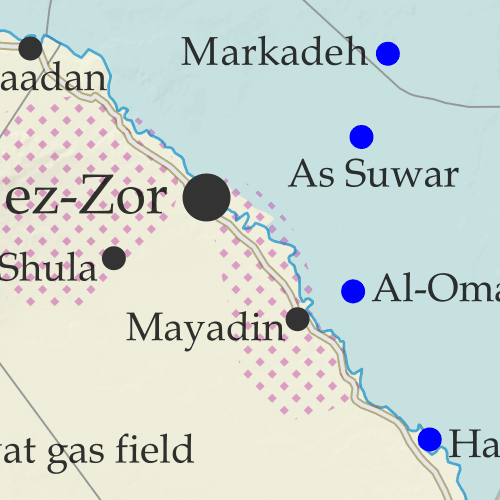
Thumbnail preview of Syrian Civil War map: Territorial control in Syria in July 2023 (Free Syrian Army rebels, Kurdish YPG, Syrian Democratic Forces (SDF), Hayat Tahrir al-Sham (HTS / Al-Nusra Front), and others). Includes areas of dispersed operational presence for so-called Islamic State (ISIS/ISIL), Turkish/TFSA control, joint SDF-Assad control, US deconfliction zone, and Turkey-Russia security corridor, plus recent locations of conflict, including Afrin, Tanf, Al-Kawm, and more. Colorblind accessible.For years there have been no lasting changes to the lines of control in Syria's nearly-frozen civil war, but sporadic fighting has continued between rival rebel groups, between Turkish-led forces and elements of the Kurdish-led Syrian Democratic Forces (SDF), and as part of the ongoing insurgency carried out by the so-called "Islamic State" (IS; formerly ISIS/ISIL).

See all this and more on the latest update to PolGeoNow's concise, professional Syrian Civil War control map, which includes a timeline of key events since our previous Syria map report from last year, with sources cited.

This map and report are premium content, available to paid subscribers of the PolGeoNow Conflict Mapping Service.

Want to see before you subscribe? Check out our most recent FREE SAMPLE Syria map!

Exclusive map report includes:

  • Up-to-date illustration of current territorial control in Syria, color-coded for the Assad government, rebel groups, and the Kurdish-led Syrian Democratic Forces (SDF). Colorblind accessible.
  • Pattern showing areas of "Islamic State" (ISIS/ISIL) dispersed operational presence now that the group has lost its last firmly-held territory.
  • Special symbols for joint Turkish/rebel control and joint SDF/government control in the border region
  • Extent of "security corridor" sponsored by Turkey and Russia in the rebel-held northwest
  • Outline showing approximate location of the one publicly-known US "deconfliction zone"
  • Special symbols indicating towns dominated by rebels of the former Al Qaeda-affiliated Nusra Front (now Hayat Tahrir al-Sham or HTS) and by the Kurdish YPG militia (part of the SDF anti-"Islamic State" coalition)
  • Detailed indication of city-by-city control, including key towns and other locations important to current events
  • Locations of recent control changes and other important events, including Afrin, Tanf, Al-Kawm, and more
  • Detailed timeline of important events and changes to territorial control since February 23, 2022, compiled by our Syria-Iraq expert, with links to sources.

SUBSCRIBERS CLICK HERE TO VIEW FULL ARTICLE AND MAP:
Old Portal (members.polgeonow.com) | New Portal (controlmaps.polgeonow.com)


Not signed up yet? Click here to learn more about our professional subscription service!

Can I purchase just this map?
This map and report are not available for automated purchase to non-subscribers. If you need access or republication rights for only this map report, contact service@polgeonow.com for options.

Saturday, March 11, 2023

Yemen Control Map & Report - March 2023 (Subscription)

SUBSCRIBERS CLICK HERE TO VIEW FULL ARTICLE AND MAP:
Old Portal (members.polgeonow.com) | New Portal (controlmaps.polgeonow.com)


(To see other maps in this series, view all Yemen articles on PolGeoNow.)

Timeline by Djordje Djukic. Map by Evan Centanni, Djordje Djukic, and onestopmap.com

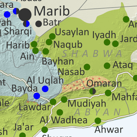
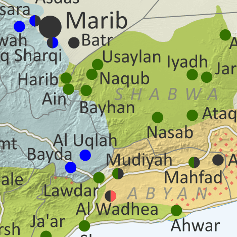
Thumbnail preview of map of what's happening in Yemen as of March 2023, showing territorial control in the PLC government infighting between Saudi-backed al-Islah and the UAE-backed STC southern separatists, as well as control by the unrecognized Houthi government and major areas of operations of Al Qaeda in the Arabian Peninsula (AQAP). Includes recent locations of fighting and other events, such as Mudiyah, Mahfad, and the Omaran Valley.

Subscribe for full access to all conflict map reports!

The separatist Southern Transitional Council has significantly consolidated its control of the south, driving Al Qaeda forces out of key strongholds and winning battles against rival affiliates of Yemen's internationally-recognized coalition government.

See all this and more on the newest update to PolGeoNow's Yemen territorial control map, which includes a timeline of changes and important events since our previous Yemen map report in April.

This map and report are premium content available to paid subscribers of the PolGeoNow Conflict Mapping Service.

Want to see before you buy? Check out our most recent FREE SAMPLE Yemen map report!

Exclusive report includes:

  • Up-to-date map of current territorial control in Yemen amid the new outbreak of fighting between factions affiliated to the internationally-recognized government, color-coded for the UAE-backed separatist Southern Transitional Council (STC) and allies, Islah party and other remaining government units, Houthi forces, and major presence of Al Qaeda in the Arabian Peninsula (AQAP)
  • Detailed indication of town-by-town control, including provincial boundaries, all major cities, and many smaller ones
  • Markers for recent areas of fighting, including Mudiyah, Mahfad, and the Omaran Valley
  • Timeline of changes to the situation since September 6, 2022, with links to sources 

SUBSCRIBERS CLICK HERE TO VIEW FULL ARTICLE AND MAP:
Old Portal (members.polgeonow.com) | New Portal (controlmaps.polgeonow.com)


Not a member yet? Click here to learn more about our professional subscription service!

Can I purchase just this map?
This map and report are not available for automated purchase to non-subscribers. If you need access or republication rights for only this map report, contact service@polgeonow.com for options.

Saturday, September 10, 2022

Yemen Control Map & Report: Separatists vs. al-Islah - September 2022

SUBSCRIBERS CLICK HERE TO VIEW FULL ARTICLE AND MAP:
Old Portal (members.polgeonow.com) | New Portal (controlmaps.polgeonow.com)


There are newer versions of this map available. To see them, view all Yemen articles on PolGeoNow.

Timeline by Djordje Djukic. Map by Evan Centanni, Djordje Djukic, and onestopmap.com

Thumbnail preview of map of what's happening in Yemen as of September 2022, showing territorial control in the PLC government infighting between Saudi-backed al-Islah and the UAE-backed STC southern separatists, as well as control by the unrecognized Houthi government and major areas of operations of Al Qaeda in the Arabian Peninsula (AQAP). Includes recent locations of fighting and other events, including Ataq, Shuqra (Shuqrah), Arma, Al Wadhea, al-Abr, and more.
Subscribe for full access to all conflict map reports!

While the ceasefire between the Houthis and Yemen's internationally-recognized PLC unity government continues to hold, a major conflict has broken out within the PLC, with UAE-backed southern separatists and their allies seemingly bent on defeating the Saudi-backed al-Islah religious party once and for all, seizing control of key oil fields along the way.

See all this and more on the newest update to PolGeoNow's Yemen territorial control map, which includes a timeline of changes and important events since our previous Yemen map report in April.

This map and report are premium content available to paid subscribers of the PolGeoNow Conflict Mapping Service.

Want to see before you buy? Check out our most recent FREE SAMPLE Yemen map report!

Exclusive report includes:

  • Up-to-date map of current territorial control in Yemen amid the new outbreak of fighting between factions affiliated to the internationally-recognized government, color-coded for the UAE-backed separatist Southern Transitional Council (STC) and allies, Islah party and other remaining government units, Houthi forces, and major presence of Al Qaeda in the Arabian Peninsula (AQAP)
  • Detailed indication of town-by-town control, including provincial boundaries, all major cities, and many smaller ones
  • Markers for recent areas of fighting, including Ataq, Shuqra, Arma, Al Wadhea, al-Abr, and more
  • Timeline of changes to the situation since April 11, 2022, with links to sources 

SUBSCRIBERS CLICK HERE TO VIEW FULL ARTICLE AND MAP:
Old Portal (members.polgeonow.com) | New Portal (controlmaps.polgeonow.com)


Not a member yet? Click here to learn more about our professional subscription service!

Can I purchase just this map?
This map and report are not available for automated purchase to non-subscribers. If you need access or republication rights for only this map report, contact service@polgeonow.com for options.

Tuesday, April 12, 2022

Yemen Control Map & Report: Truce Pauses Fighting - April 2022

There are newer versions of this map available. To see them, view all Yemen articles on PolGeoNow.

Map of what's happening in Yemen as of April 2022, showing territorial control at the time of the new truce (ceasefire), including the unrecognized Houthi government, the former forces of president-in-exile Hadi (now resigned) and his allies in the Saudi-led coalition, and the UAE-backed southern separatist Southern Transitional Council (STC), plus major areas of operations of Al Qaeda in the Arabian Peninsula (AQAP). Includes recent locations of fighting and other events, including Harib, Harad, Maydee (Midi), Yatmah, and many more.
Map by Evan Centanni and Djordje Djukic, from base map by Koen Adams of onestopmap.com.
Contact us for permission to use this map.

(View this article in the member area)

Timeline by Djordje Djukic, with additional reporting by Evan Centanni

Yemen's New Truce: Who Controls What?

Since our previous Yemen control map report of three months ago, forces of Yemen's unrecognized, Iran-backed Houthi government have rolled back their rivals' recent gains, but still haven't been able to move on the central city of Marib. Amid this stalemate, a surprise UN-brokered truce, alongside the resignation of the country's weak internationally-recognized president, has opened up new possibilities for an end to the war.

Thursday, February 24, 2022

Syria Control Map & Report - February 2022 (Subscription)

SUBSCRIBERS CLICK HERE TO PROCEED TO ARTICLE AND MAP

(To see all maps in this series, view all Syria updates.)

Research by Djordje Djukic. Map by onestopmap.com, Evan Centanni, and Djordje Djukic

Subscribe for full access to all conflict map reports!

Thumbnail preview of Syrian Civil War map: Full map shows territorial control in Syria in February 2022 (Free Syrian Army rebels, Kurdish YPG, Syrian Democratic Forces (SDF), Hayat Tahrir al-Sham (HTS / Al-Nusra Front), and others). Includes areas of dispersed operational presence for so-called Islamic State (ISIS/ISIL), Turkish/TFSA control, joint SDF-Assad control, US deconfliction zone, and Turkey-Russia security corridor, plus recent locations of conflict and territorial control changes, including Tafas, Atmah, Ithriya (Athriyah), Ayn Issa and more. Colorblind accessible. Despite no changes to Syria's lines of control since 2020, the so-called "Islamic State" (ISIS/ISIL) has continued a bloody insurgency in the central desert, which has increasingly occupied the Assad government and its Russian and Iranian allies. Meanwhile, fighting between Kurdish- and Turkish-led forces has carried on sporadically, and a sort of rebel resurgence in the southwest has come and gone.

See all this and more on the latest update to PolGeoNow's concise, professional Syrian Civil War control map, which includes a timeline of changes since our previous Syria map report last November, with sources cited.

This map and report are premium content, available to paid subscribers of the PolGeoNow Conflict Mapping Service.

Want to see before you subscribe? Check out our most recent FREE SAMPLE Syria map!

Exclusive map report includes:
  • Up-to-date illustration of current territorial control in Syria, color-coded for the Assad government, rebel groups, and the Kurdish-led Syrian Democratic Forces (SDF). Colorblind accessible.
  • Pattern showing areas of "Islamic State" (ISIS/ISIL) dispersed operational presence now that the group has lost its last firmly-held territory.
  • Special symbols for joint Turkish/rebel control and joint SDF/government control in the border region
  • Extent of "security corridor" sponsored by Turkey and Russia in the rebel-held northwest
  • Outline showing approximate location of the one publicly-known US "deconfliction zone"
  • Special symbols indicating towns dominated by rebels of the former Al Qaeda Nusra Front (now Hayat Tahrir al-Sham or HTS) and by the Kurdish YPG militia (part of the SDF anti-"Islamic State" coalition)
  • Detailed indication of city-by-city control, including key towns and other locations important to current events
  • Locations of recent control changes and other important events, including Tafas, Ayn Issa, Resafa, Atmah, and more
  • Detailed timeline of important events and changes to territorial control since November 22, 2020, compiled by our Syria-Iraq expert, with links to sources.

SUBSCRIBERS CLICK HERE TO PROCEED TO ARTICLE AND MAP

Not signed up yet? Click here to learn more about our professional subscription service!

Can I purchase just this map?
This map and report are not available for automated purchase to non-subscribers. If you need access or republication rights for only this map report, contact service@polgeonow.com for options.

Friday, January 28, 2022

Yemen Control Map & Report: Houthis on the Backstep - January 2022 (Subscription)

SUBSCRIBERS CLICK HERE TO PROCEED TO ARTICLE AND MAP

There are newer versions of this map available. To see them, view all Yemen articles on PolGeoNow.

Timeline by Djordje Djukic. Map by Evan Centanni, Djordje Djukic, and onestopmap.com

Map of what's happening in Yemen as of January 2022, including territorial control for the unrecognized Houthi government, president-in-exile Hadi and his allies in the Saudi-led coalition, and the UAE-backed southern separatist Southern Transitional Council (STC), plus major areas of operations of Al Qaeda in the Arabian Peninsula (AQAP). Includes recent locations of fighting and other events, including Balaq al-Sharqi, Usaylan, Harib, Yatmah, Batr, and many more.
Subscribe for full access to all conflict map reports!

Yemen's internationally-recognized Hadi government has won a bit of breathing room in recent weeks, rolling back a swath of Houthi territory south of Marib, though Houthi forces still retain a foothold at the city's doorstep.

See all this and more on the newest update to PolGeoNow's Yemen territorial control map, which includes a timeline of changes and important events since our previous Yemen map report in November.

This map and report are premium content available to paid subscribers of the PolGeoNow Conflict Mapping Service.

Want to see before you buy? Check out our most recent FREE SAMPLE Yemen map report!

Exclusive report includes:
  • Up-to-date map of current territorial control in Yemen, color-coded for the pro-Hadi coalition, the separatist Southern Transitional Council (STC), Houthi forces, and major presence of Al Qaeda in the Arabian Peninsula (AQAP)
  • Detailed indication of town-by-town control, including provincial boundaries, all major cities, and many smaller ones
  • Markers for recent areas of fighting, including Balaq al-Sharqi, Usaylan, Harib, Batr, and many more
  • Timeline of changes to the situation since November 30, 2021, with links to sources 

SUBSCRIBERS CLICK HERE TO PROCEED TO ARTICLE AND MAP

Not a member yet? Click here to learn more about our professional subscription service!

Can I purchase just this map?
This map and report are not available for automated purchase to non-subscribers. If you need access or republication rights for only this map report, contact service@polgeonow.com for options.

Wednesday, December 1, 2021

Yemen Control Map & Report: Hadi Forces Leave Hodeida - November 2021 (Subscription)

SUBSCRIBERS CLICK HERE TO PROCEED TO ARTICLE AND MAP

There are newer versions of this map available. To see them, view all Yemen articles on PolGeoNow.

Timeline by Djordje Djukic. Map by Evan Centanni, Djordje Djukic, and onestopmap.com

Map of what's happening in Yemen as of November 2021, including territorial control for the unrecognized Houthi government, president-in-exile Hadi and his allies in the Saudi-led coalition, and the UAE-backed southern separatist Southern Transitional Council (STC), plus major areas of operations of Al Qaeda in the Arabian Peninsula (AQAP). Includes recent locations of fighting and other events, including Al Khanjar, Al Tuhayta, Jubah, Abdiyah, and many more.
Subscribe for full access to all conflict map reports!

Yemen's unrecognized Houthi government has assumed control of the port city Hodeida and much of the Red Sea coast after opposing forces withdrew. Meanwhile, the Houthis have also continued to slowly gain ground against supporters of Saudi-backed President Hadi in the country's center.

See all this and more on the newest update to PolGeoNow's Yemen territorial control map, which includes a timeline of changes and important events since our previous Yemen map report in September.

This map and report are premium content available to paid subscribers of the PolGeoNow Conflict Mapping Service.

Want to see before you buy? Check out our most recent FREE SAMPLE Yemen map report!

Exclusive report includes:
  • Up-to-date map of current territorial control in Yemen, color-coded for the pro-Hadi coalition, the separatist Southern Transitional Council (STC), Houthi forces, and major presence of Al Qaeda in the Arabian Peninsula (AQAP)
  • Detailed indication of town-by-town control, including provincial boundaries, all major cities, and many smaller ones
  • Markers for recent areas of fighting, including Al Khanjar, Al Tuhayta, Jubah, Abdiyah, and many more
  • Timeline of changes to the situation since September 28, 2021, with links to sources 

SUBSCRIBERS CLICK HERE TO PROCEED TO ARTICLE AND MAP

Not a member yet? Click here to learn more about our professional subscription service!

Can I purchase just this map?
This map and report are not available for automated purchase to non-subscribers. If you need access or republication rights for only this map report, contact service@polgeonow.com for options.

Tuesday, September 28, 2021

Yemen Control Map & Report: Houthis Expand in South - September 2021 (Subscription)

SUBSCRIBERS CLICK HERE TO PROCEED TO ARTICLE AND MAP

There are newer versions of this map available. To see them, view all Yemen articles on PolGeoNow.

Timeline by Djordje Djukic. Map by Evan Centanni, Djordje Djukic, and onestopmap.com

Map of what's happening in Yemen as of September 2021, including territorial control for the unrecognized Houthi government, president-in-exile Hadi and his allies in the Saudi-led coalition, and the UAE-backed southern separatist Southern Transitional Council (STC), plus major areas of operations of Al Qaeda in the Arabian Peninsula (AQAP). Includes recent locations of fighting and other events, including Marib, Rahabah, Harib, Bayhan, and many more.
Subscribe for full access to all conflict map reports!

Forces aligned with internationally-recognized President Hadi have successfully defended the central Yemeni city of Marib from the Houthis. But Houthi forces have continued their forward march elsewhere, securing full control of Bayda province and growing their territory in Marib and Shabwa provinces.

See all this and more on the newest update to PolGeoNow's Yemen territorial control map, which includes a timeline of changes and important events since our previous Yemen map report in February.

This map and report are premium content available to paid subscribers of the PolGeoNow Conflict Mapping Service.

Want to see before you buy? Check out our most recent FREE SAMPLE Yemen map report!

Exclusive report includes:
  • Up-to-date map of current territorial control in Yemen, color-coded for the pro-Hadi coalition, the separatist Southern Transitional Council (STC), Houthi forces, and major presence of Al Qaeda in the Arabian Peninsula (AQAP)
  • Detailed indication of town-by-town control, including provincial boundaries, all major cities, and many smaller ones
  • Markers for recent areas of fighting, including Marib, Rahabah, Harib, Abdiyah, Bayhan, and many more
  • Timeline of changes to the situation since May 6, 2021, with links to sources 

SUBSCRIBERS CLICK HERE TO PROCEED TO ARTICLE AND MAP

Not a member yet? Click here to learn more about our professional subscription service!

Can I purchase just this map?
This map and report are not available for automated purchase to non-subscribers. If you need access or republication rights for only this map report, contact service@polgeonow.com for options.

Friday, May 14, 2021

Israel / Palestine Map: Who Controlled What in May 2021?

This is the 2021 edition of our Israel/Palestine control map, first published in July 2020. A newer version is now available.

Map of who controls Palestine and Israel's claimed territories today (May 14, 2021), as Gaza Strip violence continues to escalate? Israeli and Palestinian Authority administration (Fatah and Hamas factions indicated separately). Also file under: Palestine controlled area map. Includes bigger West Bank map (Areas A, B, C). Map also includes Gaza Strip, Golan Heights, major cities and Israeli settlements, UN peacekeeper deployments (UNIFIL and UNDOF), no man's land, Golan Heights buffer zone (area of separation, AOS), and Shebaa Farms. Colorblind accessible.
Click to enlarge. Map by Evan Centanni, incorporating base map by Koen Adams of onestopmap.com and data from B'Tselem's interactive mapping project. (Contact us for permission to use this map.)

Israel and Palestine Controlled Areas in 2021

The Israeli government's much-hyped plan to absorb parts of the Palestine-claimed West Bank into Israel in 2020 didn't happen (at least not yet). But in May 2021, the region was once again making headlines amid a new wave of fighting. So who actually controlled what parts of Palestine and Israel's claimed territories at the time? This revised version of PolGeoNow's Israel/Palestine control map lays out the details of government jurisdictions on the ground.

There were no changes to the lines of control between 2020 and this 2021 edition, but this edition of the map did feature several modifications for improved clarity and more precise depictions of the situation. If you see something you don't understand on the map, check out the latest edition of our concise outline explaining who's who and introducing each of the disputed areas.

Note that this is a map of who actually controls what, not of who claims which areas. And it's definitely not supposed to imply that any particular party should or shouldn't control any particular area. As always, PolGeoNow takes no side in these disputes, and we have done our best to report only the facts.

Newer Map and Explainer Article: Who Controls What in the Israel-Palestine conflict?

Saturday, May 8, 2021

Yemen Control Map & Report: Houthis at Marib's Doorstep - May 2021 (Subscription)

SUBSCRIBERS CLICK HERE TO PROCEED TO ARTICLE AND MAP

There are newer versions of this map available. To see them, view all Yemen articles on PolGeoNow.

Timeline by Djordje Djukic. Map by Evan Centanni, Djordje Djukic, and onestopmap.com

Map of what's happening in Yemen as of May 2021, including territorial control for the unrecognized Houthi government, president-in-exile Hadi and his allies in the Saudi-led coalition, the UAE-backed southern separatist Southern Transitional Council (STC), and Al Qaeda in the Arabian Peninsula (AQAP). Includes recent locations of fighting and other events, including Marib, Al-Sadd Lake, Kassara, Rahida, and more.
Subscribe for full access to all conflict map reports!

Yemen's Houthis have come within just a few kilometers of Marib, the last major northern stronghold of the internationally-recognized Hadi government. Meanwhile, Hadi's forces are still fighting the Houthis in the southwest too, but their ceasefire with southern separatists has continued to hold.

See all this and more on the newest update to PolGeoNow's Yemen territorial control map, which includes a timeline of changes and important events since our previous Yemen map report in February.

This map and report are premium content available to paid subscribers of the PolGeoNow Conflict Mapping Service.

Want to see before you buy? Check out our most recent FREE SAMPLE Yemen map report!

Exclusive report includes:
  • Up-to-date map of current territorial control in Yemen, color-coded for the pro-Hadi coalition, the separatist Southern Transitional Council (STC), Houthi forces, and Al Qaeda in the Arabian Peninsula (AQAP)
  • Detailed indication of town-by-town control, including provincial boundaries, all major cities, and many smaller ones
  • Markers for recent areas of fighting, including Marib, Al-Sadd Lake, Kassara, Rahida, and more
  • Timeline of changes to the situation since March 24, 2021, with links to sources 

SUBSCRIBERS CLICK HERE TO PROCEED TO ARTICLE AND MAP

Not a member yet? Click here to learn more about our professional subscription service!

Can I purchase just this map?
This map and report are not available for automated purchase to non-subscribers. If you need access or republication rights for only this map report, contact service@polgeonow.com for options.

Thursday, March 25, 2021

Yemen Control Map & Report - March 2021 (Subscription)

SUBSCRIBERS CLICK HERE TO PROCEED TO ARTICLE AND MAP

There are newer versions of this map available. To see them, view all Yemen articles on PolGeoNow.

Timeline by Djordje Djukic. Map by Evan Centanni, Djordje Djukic, and onestopmap.com

Map of what's happening in Yemen as of March 2021, including territorial control for the unrecognized Houthi government, president-in-exile Hadi and his allies in the Saudi-led coalition, the UAE-backed southern separatist Southern Transitional Council (STC), and Al Qaeda in the Arabian Peninsula (AQAP). Includes recent locations of fighting and other events, including Marib, Al-Sadd Lake, Al Ma'afer, Ahwar, and more.
Subscribe for full access to all conflict map reports!

Forces loyal to Yemen's unrecognized Houthi government have continued their gradual advance towards the central city of Marib. But for the first time in months, they've also faced a major loss of ground elsewhere, with forces loyal to the internationally-recognized President Hadi capturing territory in the southwest.

See all this and more on the newest update to PolGeoNow's Yemen territorial control map, which includes a timeline of changes and important events since our previous Yemen map report in February.

This map and report are premium content available to paid subscribers of the PolGeoNow Conflict Mapping Service.

Want to see before you buy? Check out our most recent FREE SAMPLE Yemen map report!

Exclusive report includes:
  • Up-to-date map of current territorial control in Yemen, color-coded for the pro-Hadi coalition, the separatist Southern Transitional Council (STC), Houthi forces, and Al Qaeda in the Arabian Peninsula (AQAP)
  • Detailed indication of town-by-town control, including provincial boundaries, all major cities, and many smaller ones
  • Markers for recent areas of fighting, including Marib, Al-Sadd Lake, Al Ma'afer, Ahwar, and more
  • Timeline of changes to the situation since February 26, 2021, with links to sources 

SUBSCRIBERS CLICK HERE TO PROCEED TO ARTICLE AND MAP

Not a member yet? Click here to learn more about our professional subscription service!

Can I purchase just this map?
This map and report are not available for automated purchase to non-subscribers. If you need access or republication rights for only this map report, contact service@polgeonow.com for options.