Showing posts with label premium. Show all posts

Friday, December 20, 2024

Syria: Map of Control After the Fall of Assad - Dec. 14, 2024 (Subscription)

SUBSCRIBERS CLICK HERE TO VIEW FULL ARTICLE AND MAP:
Old Portal (members.polgeonow.com) | New Portal (controlmaps.polgeonow.com)


There are newer editions of this map available. To see them, view all Syria updates.

Research by Djordje Djukic, with additional reporting by Evan Centanni. Map by onestopmap.com, Evan Centanni, and Djordje Djukic

Subscribe for full access to all conflict map reports!

Thumbnail preview of Syrian Civil War map: Territorial control in Syria on December 14, 2024, almost a week after the final collapse of the Assad government (Hayat Tahrir al-Sham (HTS / Al-Nusra Front), Free Syrian Army and Syrian National Army rebels backed by Türkiye (Turkey), Kurdish YPG, Syrian Democratic Forces (SDF), Israeli military (IDF), and remaining Russian bases). Includes areas of major known activity for so-called Islamic State (ISIS/ISIL), Turkish presence, and US deconfliction zone, plus recent locations of conflict and other events, including Manbij, Tanf, Al-Kawm, Hmeimim (Khmeimim) airbase, Russia's Tartus naval base, Al-Ba'ath, and more.As the Syrian government collapsed, rebel forces spread out to assert themselves as the new authorities across most of the country, though much remains to be settled. Turkish-backed rebels jockeyed with the Kurdish-led SDF for control of the north and east, while Israel sent troops towards Damascus and the so-called "Islamic State" (ISIS/ISIL) attempted a resurgence in the central desert.

See all this and more on the latest update to PolGeoNow's concise, professional Syrian Civil War control map, which includes a timeline of key events since our previous Syria map report illustrating the situation eight days earlier, with sources cited.

This map and report are premium content, available to paid subscribers of the PolGeoNow Conflict Mapping Service.

Want to see before you subscribe? Check out our most recent FREE SAMPLE Syria map!

Exclusive map report includes:

  • Up-to-date illustration of current territorial control in Syria, color-coded for the victorious rebel coalition, the Kurdish-led Syrian Democratic Forces (SDF), resurgent forces of the so-called "Islamic State" (ISIS/ISIL), the Israeli military, and the two remaining Russian military bases in the country.
  • Pattern showing the major areas of "Islamic State" (ISIS/ISIL) activity beyond what the group fully controls.
  • Special symbol for joint Turkish/rebel control and in the border region
  • Outline showing approximate location of the US-declared "deconfliction zone"
  • Special symbols indicating towns dominated by the rebels of Hayat Tahrir al-Sham (HTS) - formerly the Al Qaeda-affiliated Nusra Front - and by the Kurdish YPG militia (part of the SDF anti-"Islamic State" coalition)
  • Detailed indication of city-by-city control, including key towns and other locations important to current events
  • Locations of recent control changes and other important events, including Manbij, Tanf, Al Kawm, Hmeimim (Khmeimim) airbase, Russia's Tartus naval base, Al-Ba'ath, and more
  • Detailed timeline of important events and changes to territorial control since December 6, 2024, with links to sources.

SUBSCRIBERS CLICK HERE TO VIEW FULL ARTICLE AND MAP:
Old Portal (members.polgeonow.com) | New Portal (controlmaps.polgeonow.com)


Not signed up yet? Click here to learn more about our professional subscription service!

Can I purchase just this map?
This map and report are not available for automated purchase to non-subscribers. If you need access or republication rights for only this map report, contact service@polgeonow.com for options.

Sunday, December 1, 2024

Ukraine: Map of Russian Control in February 2024 (Subscription)

SUBSCRIBERS CLICK HERE TO VIEW FULL ARTICLE AND MAP:
Old Portal (members.polgeonow.com) | New Portal (controlmaps.polgeonow.com)

(To see other maps in this series, view all Ukraine articles on PolGeoNow.) Hidden image for crawlers

Research by Djordje Djukic. Map by Evan Centanni and Djordje Djukic

Subscribe for full access to all conflict map reports!

Thumbnail previewing map of Russian-controlled territory in Ukraine on Februaryy 19, 2024. In addition to the Crimean peninsula, which Russia had already seized in 2014, and parts of the far eastern Donetsk and Luhansk provinces (the Donbas region) already controlled by Russia-backed separatist rebels (and formerly declared independent as the Donetsk and Lugansk People's Republics), Russian forces still controlled a wide belt of territory just north of Crimea, including large parts of Kherson and Zaporizhzhia provinces, as well as large additional areas of Donetsk and Luhansk provinces. Meanwhile, all of those provinces are now claimed by the Russian government as parts of Russia, creating a new claimed international border through what was until recently undisputed eastern Ukraine. This map shows the situation at the end of the Battle of Avdiivka, when Russia captured that Ukrainian stronghold town. Map includes key locations from the news, such as Adviivka, Marinka, Synkivka, Pischane, Krynky, and more. Colorblind accessible.

Late 2023 and early 2024 saw small but steady gains by Russian forces across eastern Ukraine, capped by the milestone capture of Ukrainian stronghold town Avdiivka near Donetsk city. This shift in favor of Russia heralded the end of Ukraine's much-hyped 2023 counter-offensive, which had achieved disappointingly modest results.

(The maps in this report show the situation as of February 19, 2024. Territorial changes since that time, including Ukraine's surprise incursion into Russia, will be covered in a future report.)

See all this and more on the latest update to PolGeoNow's concise, professional Ukraine war control map, which includes a detailed chronicle of changes and events since our previous Ukraine map report illustrating the situation in October 2023, with sources cited, as well as a close-up map of control within the claimed borders of the Donetsk and Lugansk People's Republics (which now claim to be self-governing regions inside Russia).

This map and report are premium content, available to paid subscribers of the PolGeoNow Conflict Mapping Service.

Want to see before you subscribe? Check out our most recent FREE SAMPLE Ukraine map!

Exclusive map report includes:

  • Illustration of current territorial control in Ukraine in February 2024, color-coded for the Ukrainian government on one side and the Russian military and allied forces on the other side, with areas of uncertainty indicated. Colorblind accessible.
  • Darker color indicating which areas were already under Russian or allied control before the 2022 invasion began
  • Lines showing Russia's claimed border after its annexations of Donetsk, Luhansk, Zaporizhzhia, and Kherson provinces.
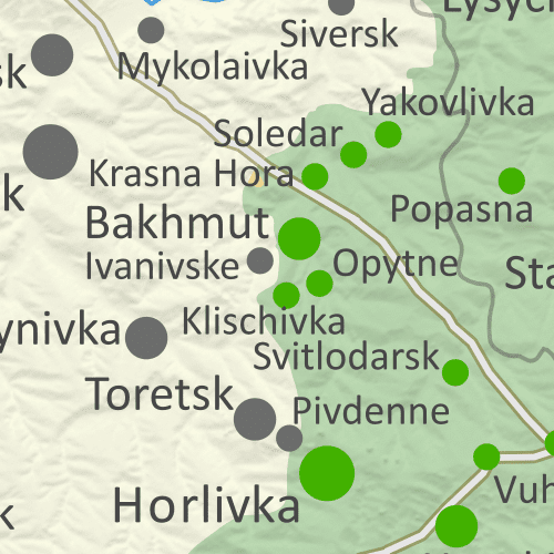
  • Preview thumbnail of map of territorial control within the claimed borders of the self-declared Donetsk People's Republic (DPR) and Lugansk People's Republic (LPR), which now consider themselves part of Russia, updated to February 19, 2024. Map shows that the vast majority of the LPR, otherwise known as Ukraine's Luhansk province, is now under the control of Russia, while Russian forces also control over half of the DPR, or Ukraine's Donetsk province, including the major central and southern cities of Donetsk, Horlivka, Makiyivka, and Mariupol. Includes key locations from the news, such as Avdiivka, Marinka, Terny, Yakovlivka, Novomykhailivka, and many more. Colorblind accessible.
    Donbas close-up map
    Close-up map of territorial control within the self-proclaimed boundaries of the Donetsk People's Republic and Lugansk People's Republic, which now claim to be part of Russia
  • Detailed indication of city-by-city control, including key towns and other locations important to current events
  • Locations of recent control changes and other important events, including Avdiivka, Marinka, Krynky, Terny, Pischane, Novomykhailivka, and more
  • Detailed timeline of important events and changes to territorial control from October 9, 2023 to February 19, 2024, with links to sources.

SUBSCRIBERS CLICK HERE TO VIEW FULL ARTICLE AND MAP:
Old Portal (members.polgeonow.com) | New Portal (controlmaps.polgeonow.com)


Not signed up yet? Click here to learn more about our professional subscription service!

Can I purchase just this map?
This map and report are not available for automated purchase to non-subscribers. If you need access or republication rights for only this map report, contact service@polgeonow.com for options.

Sunday, October 6, 2024

Israel / Palestine: Map of Control at Start of Lebanon Incursion - Oct. 6, 2024 (Subscription)

SUBSCRIBERS CLICK HERE TO VIEW FULL ARTICLE AND MAP:
Old Portal (members.polgeonow.com) | New Portal (controlmaps.polgeonow.com)


(To see more maps in this series, view all Israel articles or Palestine articles on PolGeoNow.)

Map by Evan Centanni, timeline by Djordje Djukic with Evan Centanni

Subscribe for full access to all conflict map reports!

Thumbnail preview of map of who controlled Palestine and Israel's claimed territories on October 6, 2024, soon after the beginning of Israel's ground incursion into Lebanon. Shows both Israeli and Palestinian Authority administration (Fatah and Hamas factions indicated separately). Includes bigger West Bank map (Area A, Area B, and Area C). Map also includes Gaza Strip, Golan Heights, major cities and Israeli settlements, UN peacekeeper deployments (UNIFIL in Lebanon and UNDOF in Syria), no man's land, Golan Heights buffer zone (area of separation, AOS), and Shebaa Farms. Also shows which areas of Israel proper are under the greatest military restrictions, including the so-called Gaza Envelope and Confrontation Line zones as well as much of northern Israel. Includes all major cities and various key towns and sites from the news, like Khan Yunis, Nevatim airbase, Hatzerim and Tel Nof airbases, Jabalia, Yaroun, Adeissah, Jenin, Tulkarm, Tubas, and more, as well as the so-called Philadelphi Corridor and Netzarim Corridor in the Gaza Strip. Colorblind accessible.

What some once called the "Gaza War" is now unquestionably something much bigger, with Israel directing much of its military force instead across the Lebanon border at the Hezbollah militia, assassinating enemies across the middle east, and coming under major direct attack from Iran. Ground fighting in the Gaza Strip has eased, but Israeli airstrikes continue, and Israeli military actions have intensified in the West Bank.

See all this and more in the latest update to PolGeoNow's widely-acclaimed map of territorial administration in the Israel/Palestine area. In addition to the updated map, the report also includes a detailed chronicle of changes and events since June 27, 2024, the date illustrated by our previous Israel/Palestine control map.

This map and report are premium content, available to paid subscribers of the PolGeoNow Conflict Mapping Service.

Want to see before you subscribe? Check out our most recent FREE SAMPLE Israel/Palestine map report!

Exclusive map report includes:

  • Up-to-date illustration of current territorial control across all areas claimed by either Israel or Palestine, including Hamas and Israeli military control in the Gaza Strip (not in extreme detail), as well as UN peacekeeper deployments just outside the region
  • Closer-up inset map showing the divisions in the West Bank: Israeli military control ("Area C", including Israeli settlements), Fatah-led Palestinian jurisdiction ("Area A"), zones of shared administration ("Area B"), and the (annexed) area of Israeli civilian control in East Jerusalem
  • Lines illustrating the pre-1967 ceasefire boundaries separating Israel proper from the Palestinian-claimed Gaza Strip and West Bank, as well as the Syria-claimed Golan Heights
  • Labels for contentious areas, like the Gaza Strip, West Bank, Golan Heights, Shebaa Farms, and "no man's land"
  • Illustration of which parts of Israel proper are subject to the greatest restrictions by military decree under current war powers: the "Gaza Envelope" in the south and the "Confrontation Line" in the north, and now much of northern Israel and the Golan Heights.
  • Detailed indication of city-by-city control, including key towns and other locations important to current events, including in the West Bank contested towns across the border in Lebanon
  • Locations of recent control changes and other important events, including Khan Yunis, Nevatim airbase, Hatzerim and Tel Nof airbases, Jabalia, Yaroun, Adeissah, Jenin, Tulkarm, Tubas, and more, as well as the so-called Philadelphi Corridor and Netzarim Corridor in the Gaza Strip
  • Detailed timeline of important events and changes to territorial control since June 27, 2024, with links to sources.
  • Additional timeline entries chronicling events in all four additional fronts to the conflict: (1) the Lebanon border, where Israel and Hezbollah are engaged in cross-border strikes and now an Israeli ground incursion; (2) the West Bank, where near-daily Israeli raids on Palestinian-governed cities have have recently become more intense and destructive; (3) attacks on Western shipping in the Red Sea and Gulf of Aden near Yemen, where the US and UK have retaliated militarily against the Yemeni "Houthi" government; and (4) increasing related violence across the Middle East, including direct Iranian and Houthi attacks on Israel; Israeli airstrikes and assassinations in Lebanon, Syria, and Iran; and resumed Iran-backed militia attacks on US forces in Iraq and Syria (Fronts 3 and 4 are not illustrated on the map).

SUBSCRIBERS CLICK HERE TO VIEW FULL ARTICLE AND MAP:
Old Portal (members.polgeonow.com) | New Portal (controlmaps.polgeonow.com)


Not signed up yet? Click here to learn more about our professional subscription service!

Can I purchase just this map?
This map and report are not available for automated purchase to non-subscribers. If you need access or republication rights for only this map report, contact service@polgeonow.com for options.

Saturday, June 29, 2024

Israel / Palestine: Map of Control Amid Rafah Offensive - June 27, 2024 (Subscription)

SUBSCRIBERS CLICK HERE TO VIEW FULL ARTICLE AND MAP:
Old Portal (members.polgeonow.com) | New Portal (controlmaps.polgeonow.com)


There are newer editions of this map available. To see them, view all Israel articles or Palestine articles on PolGeoNow.

Map by Evan Centanni, timeline by Djordje Djukic with Evan Centanni

Subscribe for full access to all conflict map reports!

Thumbnail preview of map of who controlled Palestine and Israel's claimed territories on June 27, 2024, during the so-called Rafah offensive. Shows both Israeli and Palestinian Authority administration (Fatah and Hamas factions indicated separately). Includes bigger West Bank map (Area A, Area B, and Area C). Map also includes Gaza Strip, Golan Heights, major cities and Israeli settlements, UN peacekeeper deployments (UNIFIL in Lebanon and UNDOF in Syria), no man's land, Golan Heights buffer zone (area of separation, AOS), and Shebaa Farms. New edition also shows so-called Gaza Envelope and Confrontation Line zones, the areas of Israel proper are under the greatest military restrictions. Includes all major cities and various key towns and sites from the news, like Rafah, Nuseirat Refugee Camp, the US floating pier (humanitarian aid pier), Mount Meron, Hebbariye, Jenin, Tulkarm, and more. Now with improved colorblind accessibility.

Over the last four months, Israel first withdrew most its forces from the Gaza Strip, soon sent them back into certain areas, then began a scaled-down version of its long-promised Rafah offensive. Its forces now hold part of Rafah and other specific areas, while the UN says there's “no authority in most of the territory”. 

Meanwhile, related violence has continued along the Lebanon border, in the West Bank, and in the Red Sea, with broader Middle East tensions reaching a peak in mid-April with a direct exchange of fire between Israel and Iran.

See all this and more in the latest update to PolGeoNow's widely-acclaimed map of territorial administration in the Israel/Palestine area. In addition to the updated map, the report also includes a detailed chronicle of changes and events since March 4, 2024, the date illustrated by our previous Israel/Palestine control map.

This map and report are premium content, available to paid subscribers of the PolGeoNow Conflict Mapping Service.

Want to see before you subscribe? Check out our most recent FREE SAMPLE Israel/Palestine map report!

Exclusive map report includes:

  • Up-to-date illustration of current territorial control across all areas claimed by either Israel or Palestine, including Hamas and Israeli military control in the Gaza Strip (not in extreme detail), as well as UN peacekeeper deployments just outside the region
  • Closer-up inset map showing the divisions in the West Bank: Israeli military control ("Area C", including Israeli settlements), Fatah-led Palestinian jurisdiction ("Area A"), zones of shared administration ("Area B"), and the (annexed) area of Israeli civilian control in East Jerusalem
  • Lines illustrating the pre-1967 ceasefire boundaries separating Israel proper from the Palestinian-claimed Gaza Strip and West Bank, as well as the Syria-claimed Golan Heights
  • Labels for contentious areas, like the Gaza Strip, West Bank, Golan Heights, Shebaa Farms, and "no man's land"
  • Illustration of which parts of Israel proper are subject to the greatest restrictions by military decree under current war powers: the "Gaza Envelope" in the south and the "Confrontation Line" in the north, as well as known closed areas of the Golan Heights
  • Detailed indication of city-by-city control, including key towns and other locations important to current events, including in the West Bank and along the border with Israel and Lebanon
  • Locations of recent control changes and other important events, including Rafah, Nuseirat Refugee Camp, the US floating humanitarian pier, Mt. Meron, Hebbariye, Jenin, Tulkarm, and more
  • Detailed timeline of important events and changes to territorial control since March 4, 2024, with links to sources.
  • Additional timeline entries chronicling events in all four additional fronts to the conflict: (1) the Lebanon border, where Israel and Hezbollah are engaged in cross-border strikes; (2) the West Bank, where near-daily Israeli raids on Palestinian-governed cities have led to intense clashes; (3) attacks on Western shipping in the Red Sea and Gulf of Aden near Yemen, where the US and UK have retaliated militarily against the Yemeni "Houthi" government; and (4) the recent flare-up of direct violence between Israeli and Iran, including Israeli strikes on Iran-aligned targets in Syria (Fronts 3 and 4 are not illustrated on the map).

SUBSCRIBERS CLICK HERE TO VIEW FULL ARTICLE AND MAP:
Old Portal (members.polgeonow.com) | New Portal (controlmaps.polgeonow.com)


Not signed up yet? Click here to learn more about our professional subscription service!

Can I purchase just this map?
This map and report are not available for automated purchase to non-subscribers. If you need access or republication rights for only this map report, contact service@polgeonow.com for options.

Tuesday, June 11, 2024

Sudan Control Map & Timeline: RSF Takes Eastern City - Jan. 2024 (Subscription)

Hidden image for crawlersSUBSCRIBERS CLICK HERE TO VIEW FULL ARTICLE AND MAP:
Old Portal (members.polgeonow.com) | New Portal (controlmaps.polgeonow.com)


There are newer editions of this map available. To see them, view all Sudan articles on PolGeoNow.

Map and article by Evan Centanni and Djordje Djukic

Subscribe for full access to all conflict map reports!

(Thumbnail preview) Sudan War: Map of who controlled what in Sudan on January 31, 2024, showing the situation after the RSF takeover of Wad Medani and most of Gezira (Jazira) state. Best Sudan control map online, thoroughly researched for maximum accuracy. Shows territorial control by the government-affiliated Sudanese Armed Forces (SAF), the Rapid Support Forces (RSF) paramilitary, and rebel groups in Sudan including the Sudan Liberation Army/Movement's Abdelwahid El Nur faction (SLA-AW/SLM-AW) in Darfur's Jebel Marra, the SPLM-N faction of Abdelaziz El Hilu in the Two Areas of South Kordofan (Nuba Mountains) and Blue Nile. Also shows the area of control of the Ngok Dinka Abyei Area Administration (AAA) within the disputed Abyei Box, and the general area of presence and major bases of the neutral Joint Force of Darfur former rebel groups. Includes disputed territories claimed by other countries, including the Halaib Triangle, Bir Tawil, and Wadi Halfa Salient along the border with Egypt, plus Kafia Kingi, 14-mile, Abyei, Heglig, Kaka, and Bebnis (Babnis) along the South Sudan border, showing which parts are controlled by which country. Includes key towns and other locations from the news, including Sennar, El Giteina (Gitaina), Al Hasaheisa, Rufaa, Bara, Habila, Nertiti, Umbro (Umm Baru), Tina border crossing, Shendi, Jebel Moon, Babanusa, Um Rawaba and many more.

In December 2024, Sudan's defiant Rapid Support Forces (RSF) paramilitary made waves by invading new parts of Sudan's eastern heartland, capturing the major city of Wad Medani and most of Gezira (Al-Jazirah) state. Meanwhile, a new battle was brewing in Darfur as tensions reached a peak in El Fasher, where our map now shows areas of control and presence for the neutral former rebel groups of the Joint Force.

(This edition of our new Sudan map series depicts control at the end of January 2024 based on research conducted through mid-June.)

See all this and more in the latest update to PolGeoNow's rigorously-researched and exhaustively cited Sudan control map and report - the most precise and accurate available online. Besides the updated map, the report also includes a brief who's-who of Sudan's rebel and former rebel groups, plus a detailed chronicle of changes and events since December 5, 2023, the date illustrated by our previous Sudan control map.

This map and report are premium content, available to paid subscribers of the PolGeoNow Control Maps Subscription Service.

Want to see before you subscribe? Check out our most recent FREE SAMPLE Sudan map report!

Exclusive map report includes:

  • Up-to-date illustration of current territorial control in Sudan's new civil war between the Sudanese Armed Forces (official government military) and Rapid Support Forces (RSF) paramilitary group, rigorously corroborated, with areas of ambiguity clearly indicated. 
  • Detailed and carefully-researched illustration of territorial control by Sudan's two major "holdout" rebel forces from before the 2023 war: SPLM-N El Hilu in South Kordofan and Blue Nile states, and the SLM-AW (SLA-AW) in Darfur's Jebel Marra. 
  • NEW: Indication of power centers and area of presence for Darfur's neutral Joint Force of former rebel groups
  • Brief who's-who guide to all the major groups and factions among Sudan's rebels and former rebels
  • Detailed explanation of what each color represents on the map, and which forces are included as "allies" of each side
  • Thoroughly-researched depictions of each disputed territory claimed by Sudan along the Egyptian and South Sudanese borders, marking which parts are controlled by the other countries and which parts by other groups (e.g. UN peacekeepers and the Ngok Dinka "Abyei Area Administration").
  • Detailed indication of city-by-city control, including key towns and other locations important to current events
  • Locations of recent control changes and other important events, including El Giteina (Gitaina), Al Hasaheisa, Rufaa, Bara, Habila, Nertiti, Umbro (Umm Baru), Tina border crossing, Shendi, Jebel Moon, Babanusa, Um Rawaba, and many more
  • Detailed timeline of important events and changes to territorial control from December 5, 2023 through January 31, 2024, with links to sources.

SUBSCRIBERS CLICK HERE TO VIEW FULL ARTICLE AND MAP:
Old Portal (members.polgeonow.com) | New Portal (controlmaps.polgeonow.com)


Not signed up yet? Click here to learn more about our professional subscription service!

Can I purchase just this map?
This map and report are not available for automated purchase to non-subscribers. If you need access or republication rights for only this map report, contact service@polgeonow.com for options.

Saturday, March 9, 2024

Israel / Palestine: Map of Control on March 4, 2024 (Subscription)

SUBSCRIBERS CLICK HERE TO VIEW FULL ARTICLE AND MAP:
Old Portal (members.polgeonow.com) | New Portal (controlmaps.polgeonow.com)


There are newer editions of this map available. To see them, view all Israel articles or Palestine articles on PolGeoNow.

Map by Evan Centanni, timeline by Djordje Djukic with Evan Centanni

Subscribe for full access to all conflict map reports!

Thumbnail preview of map of who controlled Palestine and Israel's claimed territories on March 4, 2024, four months into the Israeli (IDF) ground invasion of the Gaza Strip, and before the threatened assault on Rafah. Shows both Israeli and Palestinian Authority administration (Fatah and Hamas factions indicated separately). Includes bigger West Bank map (Area A, Area B, and Area C). Map also includes Gaza Strip, Golan Heights, major cities and Israeli settlements, UN peacekeeper deployments (UNIFIL in Lebanon and UNDOF in Syria), no man's land, Golan Heights buffer zone (area of separation, AOS), and Shebaa Farms. New edition also shows so-called Gaza Envelope and Confrontation Line zones, the areas of Israel proper are under the greatest military restrictions. Includes all major cities and various key towns and sites from the news, like Khan Yunis, Jabalia (Jabaliya), Maghazi Refugee Camp, Abasan al-Kabira, Kerem Shalom crossing, Jenin, Tulkarm, and more. Now with improved colorblind accessibility.

In the past three months, Israel's counter-invasion of the Gaza Strip has slowly ground on, with the shift focusing from Gaza City in the north to Khan Yunis in the south, and possibly to Rafah next. However, much of the Strip still remains outside of Israeli control, while closely-related violence continues at a lower level in the West Bank, on the Lebanon border, and as far afield as Yemen and Iraq.

See all this and more in the latest update to PolGeoNow's widely-acclaimed map of territorial administration in the Israel/Palestine area. In addition to the updated map, the report also includes a detailed chronicle of changes and events since December 8, 2023, the date illustrated by our previous Israel/Palestine control map.

This map and report are premium content, available to paid subscribers of the PolGeoNow Conflict Mapping Service.

Want to see before you subscribe? Check out our most recent FREE SAMPLE Israel/Palestine map report!

Exclusive map report includes:

  • Up-to-date illustration of current territorial control across all areas claimed by either Israel or Palestine, including Hamas and Israeli military control in the Gaza Strip (not in extreme detail), as well as UN peacekeeper deployments just outside the region
  • Closer-up inset map showing the divisions in the West Bank: Israeli military control (including Jewish settlements), Fatah-led Palestinian jurisdiction, areas of shared administration, and the (annexed) area of Israeli civilian control in East Jerusalem
  • Lines illustrating the pre-1967 ceasefire boundaries separating Israel proper from the Palestinian-claimed Gaza Strip and West Bank, as well as the Syria-claimed Golan Heights
  • Labels for contentious areas, like the Gaza Strip, West Bank, Golan Heights, Shebaa Farms, and "no man's land"
  • Illustration of which parts of Israel proper are subject to the greatest restrictions by military decree under current war powers: the "Gaza Envelope" in the south and the "Confrontation Line" in the north
  • Detailed indication of city-by-city control, including key towns and other locations important to current events, including in the West Bank and along the border with Israel and Lebanon
  • Locations of recent control changes and other important events, including Khan Yunis, Jabalia (Jabaliya), Maghazi Refugee Camp, Abasan al-Kabira, Kerem Shalom crossing, Jenin, Tulkarm, and more.
  • Detailed timeline of important events and changes to territorial control since December 8, 2023, with links to sources.
  • Additional timeline entries chronicling events in all four additional fronts to the conflict: (1) the Lebanon border, where Israel and Hezbollah are engaged in cross-border attacks; (2) the West Bank, where near-daily Israeli raids on Palestinian-governed cities have led to intense clashes; (3) attacks on Western shipping in the Red Sea and Gulf of Aden near Yemen, where the US and UK have retaliated militarily against the "Houthi" government; and (4) tit-for-tat attacks between Iran-backed militias and the US and Israel in Syria and Iraq (Fronts 3 and 4 are not illustrated on the map).

SUBSCRIBERS CLICK HERE TO VIEW FULL ARTICLE AND MAP:
Old Portal (members.polgeonow.com) | New Portal (controlmaps.polgeonow.com)


Not signed up yet? Click here to learn more about our professional subscription service!

Can I purchase just this map?
This map and report are not available for automated purchase to non-subscribers. If you need access or republication rights for only this map report, contact service@polgeonow.com for options.

Saturday, February 10, 2024

Sudan Control Map & Timeline: RSF Takes Darfur Cities - Dec. 2023 (Subscription)

SUBSCRIBERS CLICK HERE TO VIEW FULL ARTICLE AND MAP:
Old Portal (members.polgeonow.com) | New Portal (controlmaps.polgeonow.com)


There are newer editions of this map available. To see them, view all Sudan articles on PolGeoNow.

Map and article by Evan Centanni and Djordje Djukic

Subscribe for full access to all conflict map reports!

Sudan War: Thumbnail preview of map of who controlled what in Sudan on December 5, 2023. Best Sudan control map online, thoroughly researched for maximum accuracy. Shows territorial control by the government-affiliated Sudanese Armed Forces (SAF), the Rapid Support Forces (RSF) paramilitary group, and rebel groups in Sudan including the Sudan Liberation Army/Movement's Abdelwahid El Nur faction (SLA-AW/SLM-AW) in Darfur's Jebel Marra, the SPLM-N faction of Abdelaziz El Hilu in the Two Areas of South Kordofan (Nuba Mountains) and Blue Nile. Also shows the area of control of the Ngok Dinka Abyei Area Administration (AAA) within the disputed Abyei Box. Includes disputed territories claimed by other countries, including the Halaib Triangle, Bir Tawil, and Wadi Halfa Salient along the border with Egypt, plus Kafia Kingi, 14-mile, Abyei, Heglig, Kaka, and Bebnis along the South Sudan border, showing which parts are controlled by which country. Includes key cities and other locations from the news, including Nyala, Zalingei, Ed Daein, Ardamata, Balila oil field, Shag Omar oil field, Babanusa, Um Rawaba and many more.

From October to December of 2023, the defiant Rapid Support Forces (RSF) paramilitary group accomplished a massive consolidation of control in western Sudan's Darfur region. By early December, the country’s official military had lost its footholds in four out of five of the region's state capitals - though the RSF's control of Darfur was still not as complete as most reports implied.

(This second edition of our new Sudan map series depicts control in early December 2023, based on research conducted through January of 2024. Another edition, showing the current situation in 2024, will be coming in the near future.)

See all this and more in the latest update to PolGeoNow's rigorously-researched and exhaustively cited Sudan control map and report - the most precise and accurate available online. In addition to the updated map, the report also includes a detailed chronicle of changes and events since October 9, 2023, the date illustrated by our earlier Sudan control map.

This map and report are premium content, available to paid subscribers of the PolGeoNow Conflict Mapping Service.

Want to see before you subscribe? Check out our most recent FREE SAMPLE Sudan map report!

Exclusive map report includes:

  • Up-to-date illustration of current territorial control in Sudan's new civil war between the Sudanese Armed Forces (official government military) and Rapid Support Forces (RSF) paramilitary group, rigorously corroborated, with areas of ambiguity clearly indicated. 
  • Detailed and carefully-researched illustration of territorial control by Sudan's two major "holdout" rebel forces from before the 2023 war: SPLM-N El Hilu in South Kordofan and Blue Nile states, and the SLA-AW (SLM-AW) in Darfur's Jebel Marra.
  • Thoroughly-researched depictions of each disputed territory claimed by Sudan along the Egyptian and South Sudanese borders, marking which parts are controlled by the other countries and which parts by other groups (e.g. UN peacekeepers and the Ngok Dinka "Abyei Area Administration").
  • Detailed indication of city-by-city control, including key towns and other locations important to current events
  • Locations of recent control changes and other important events, including Nyala, Zalingei, Ed Daein, Ardamata, Balila oil field, Shag Omar oil field, Babanusa, Um Rawaba, and more.
  • Detailed timeline of important events and changes to territorial control from October 9 to December 5, 2023, with links to sources.

SUBSCRIBERS CLICK HERE TO VIEW FULL ARTICLE AND MAP:
Old Portal (members.polgeonow.com) | New Portal (controlmaps.polgeonow.com)


Not signed up yet? Click here to learn more about our professional subscription service!

Can I purchase just this map?
This map and report are not available for automated purchase to non-subscribers. If you need access or republication rights for only this map report, contact service@polgeonow.com for options.

Thursday, August 31, 2023

Ukraine: Map of Russian Control in August 2023 (Subscription)

SUBSCRIBERS CLICK HERE TO VIEW FULL ARTICLE AND MAP:
Old Portal (members.polgeonow.com) | New Portal (controlmaps.polgeonow.com)


There are newer versions of this map available. To see them, view all Ukraine articles on PolGeoNow.   

Research by Djordje Djukic. Map by Evan Centanni and Djordje Djukic

Subscribe for full access to all conflict map reports!

Thumbnail previewing map of Russian-controlled territory in Ukraine on June 30, 2023. In addition to the Crimean peninsula, which Russia had already seized in 2014, and parts of the far eastern Donetsk and Luhansk provinces (the Donbas region) already controlled by Russia-backed separatist rebels (and formerly declared independent as the Donetsk and Lugansk People's Republics), Russian forces still control a wide belt of territory just north of Crimea, including large parts of Kherson and Zaporizhzhia provinces, as well as large additional areas of Donetsk and Luhansk provinces. Ukraine has recently made small advances southward in Zaporizhzhia and western Donetsk. Meanwhile, all of those provinces are now claimed by the Russian government as parts of Russia, creating a new claimed international border through what was until recently undisputed eastern Ukraine. Map includes key locations from the news, such as Orikhiv, Velyka Novosilka, Piatykhatky, the Kakhovka Dam, and more. Colorblind accessible.

Ukraine's counteroffensive against Russian control has made modest progress, even as its forces lose a comparable amount of ground in bits and pieces along the rest of the front. In particular, Russia has pushed back into parts of Kharkiv province while Ukraine makes gains in the south.

(The maps in this report show the situation as of August 18. Territorial changes since that time, including the reported Ukrainian capture of Robotyne, will be covered in the next report.)

See all this and more on the latest update to PolGeoNow's concise, professional Ukraine war control map, which includes a detailed chronicle of changes and events since our previous Ukraine map report of June 30, with sources cited, as well as a close-up map of control within the claimed borders of the Donetsk and Lugansk People's Republics (which now claim to be self-governing regions within Russia).

This map and report are premium content, available to paid subscribers of the PolGeoNow Conflict Mapping Service.

Want to see before you subscribe? Check out our most recent FREE SAMPLE Ukraine map!

Exclusive map report includes:

  • Up-to-date illustration of current territorial control in Ukraine, color-coded for the Ukrainian government on one side and the Russian military and allied forces on the other side, with areas of uncertainty indicated. Colorblind accessible.
  • Darker color indicating which areas were already under Russian or allied control before the 2022 invasion began
  • Lines showing Russia's claimed border after its annexations of Donetsk, Luhansk, Zaporizhzhia, and Kherson provinces.
  • Preview thumbnail of map of territorial control within the claimed borders of the self-declared Donetsk People's Republic (DPR) and Lugansk People's Republic (LPR), which now consider themselves part of Russia, updated to June 30, 2023, after Russia completed its capture of Bakhmut. Map shows that the vast majority of the LPR, otherwise known as Ukraine's Luhansk province, is now under the control of Russia, while Russian forces also control over half of the DPR, or Ukraine's Donetsk province, including the major central and southern cities of Donetsk, Horlivka, Makiyivka, and Mariupol. Includes key locations from the news, such as Velyka Novosilka, Makarivka, Klischivka, Adviikva, and many more. Colorblind accessible.
    Donbas close-up map
    Close-up map of territorial control within the self-proclaimed boundaries of the Donetsk People's Republic and Lugansk People's Republic, which now claim to be part of Russia
  • Detailed indication of city-by-city control, including key towns and other locations important to current events
  • Locations of recent control changes and other important events, including Robotyne, Piatykhatky, Synkivka, Kyslivka, Kotlyarivka, Staromaiorske, Urozhaine, Berkhivka, Karmazynivka, and more
  • Detailed timeline of important events and changes to territorial control since June 30, 2023, with links to sources.

SUBSCRIBERS CLICK HERE TO VIEW FULL ARTICLE AND MAP:
Old Portal (members.polgeonow.com) | New Portal (controlmaps.polgeonow.com)


Not signed up yet? Click here to learn more about our professional subscription service!

Can I purchase just this map?
This map and report are not available for automated purchase to non-subscribers. If you need access or republication rights for only this map report, contact service@polgeonow.com for options.

Friday, July 21, 2023

Syria Control Map & Report - July 2023 (Subscription)

SUBSCRIBERS CLICK HERE TO VIEW FULL ARTICLE AND MAP:
Old Portal (members.polgeonow.com) | New Portal (controlmaps.polgeonow.com)


There are newer editions of this map available. To see them, view all Syria updates.

Research by Djordje Djukic. Map by onestopmap.com, Evan Centanni, and Djordje Djukic

Subscribe for full access to all conflict map reports!

Thumbnail preview of Syrian Civil War map: Territorial control in Syria in July 2023 (Free Syrian Army rebels, Kurdish YPG, Syrian Democratic Forces (SDF), Hayat Tahrir al-Sham (HTS / Al-Nusra Front), and others). Includes areas of dispersed operational presence for so-called Islamic State (ISIS/ISIL), Turkish/TFSA control, joint SDF-Assad control, US deconfliction zone, and Turkey-Russia security corridor, plus recent locations of conflict, including Afrin, Tanf, Al-Kawm, and more. Colorblind accessible.For years there have been no lasting changes to the lines of control in Syria's nearly-frozen civil war, but sporadic fighting has continued between rival rebel groups, between Turkish-led forces and elements of the Kurdish-led Syrian Democratic Forces (SDF), and as part of the ongoing insurgency carried out by the so-called "Islamic State" (IS; formerly ISIS/ISIL).

See all this and more on the latest update to PolGeoNow's concise, professional Syrian Civil War control map, which includes a timeline of key events since our previous Syria map report from last year, with sources cited.

This map and report are premium content, available to paid subscribers of the PolGeoNow Conflict Mapping Service.

Want to see before you subscribe? Check out our most recent FREE SAMPLE Syria map!

Exclusive map report includes:

  • Up-to-date illustration of current territorial control in Syria, color-coded for the Assad government, rebel groups, and the Kurdish-led Syrian Democratic Forces (SDF). Colorblind accessible.
  • Pattern showing areas of "Islamic State" (ISIS/ISIL) dispersed operational presence now that the group has lost its last firmly-held territory.
  • Special symbols for joint Turkish/rebel control and joint SDF/government control in the border region
  • Extent of "security corridor" sponsored by Turkey and Russia in the rebel-held northwest
  • Outline showing approximate location of the one publicly-known US "deconfliction zone"
  • Special symbols indicating towns dominated by rebels of the former Al Qaeda-affiliated Nusra Front (now Hayat Tahrir al-Sham or HTS) and by the Kurdish YPG militia (part of the SDF anti-"Islamic State" coalition)
  • Detailed indication of city-by-city control, including key towns and other locations important to current events
  • Locations of recent control changes and other important events, including Afrin, Tanf, Al-Kawm, and more
  • Detailed timeline of important events and changes to territorial control since February 23, 2022, compiled by our Syria-Iraq expert, with links to sources.

SUBSCRIBERS CLICK HERE TO VIEW FULL ARTICLE AND MAP:
Old Portal (members.polgeonow.com) | New Portal (controlmaps.polgeonow.com)


Not signed up yet? Click here to learn more about our professional subscription service!

Can I purchase just this map?
This map and report are not available for automated purchase to non-subscribers. If you need access or republication rights for only this map report, contact service@polgeonow.com for options.

Wednesday, July 12, 2023

Ukraine: Map of Russian Control Amid Ukrainian Counteroffensive - June 2023 (Subscription)

SUBSCRIBERS CLICK HERE TO VIEW FULL ARTICLE AND MAP:
Old Portal (members.polgeonow.com) | New Portal (controlmaps.polgeonow.com)


There are newer versions of this map available. To see them, view all Ukraine articles on PolGeoNow.  

Research by Djordje Djukic. Map by Evan Centanni and Djordje Djukic

Subscribe for full access to all conflict map reports!

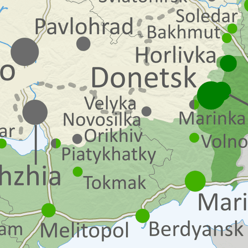
Thumbnail previewing map of Russian-controlled territory in Ukraine on June 30, 2023. In addition to the Crimean peninsula, which Russia had already seized in 2014, and parts of the far eastern Donetsk and Luhansk provinces (the Donbas region) already controlled by Russia-backed separatist rebels (and formerly declared independent as the Donetsk and Lugansk People's Republics), Russian forces still control a wide belt of territory just north of Crimea, including large parts of Kherson and Zaporizhzhia provinces, as well as large additional areas of Donetsk and Luhansk provinces. Ukraine has recently made small advances southward in Zaporizhzhia and western Donetsk. Meanwhile, all of those provinces are now claimed by the Russian government as parts of Russia, creating a new claimed international border through what was until recently undisputed eastern Ukraine. Map includes key locations from the news, such as Orikhiv, Velyka Novosilka, Piatykhatky, the Kakhovka Dam, and more. Colorblind accessible.

Ukraine's long-anticipated counteroffensive has resulted in significant, but limited, territorial gains, while apparently falling short of its hoped-for goals so far. Meanwhile, the short-lived rebellion of Russia's paramilitary Wagner Group hasn't made any obvious differences to the territorial situation.

(The maps in this report show the situation as of June 30, about two weeks ago. Territorial changes since that time have been minor, and will be covered in the next report.) 

See all this and more on the latest update to PolGeoNow's concise, professional Ukraine war control map, which includes a detailed chronicle of changes and events since our previous Ukraine map report of May 27, with sources cited, as well as a close-up map of control within the claimed borders of the Donetsk and Lugansk People's Republics (now claimed to be self-governing regions within Russia).

This map and report are premium content, available to paid subscribers of the PolGeoNow Conflict Mapping Service.

Want to see before you subscribe? Check out our most recent FREE SAMPLE Ukraine map!

Exclusive map report includes:

  • Up-to-date illustration of current territorial control in Ukraine, color-coded for the Ukrainian government on one side and the Russian military and allied forces on the other side, with areas of uncertainty indicated. Colorblind accessible.
  • Darker color indicating which areas were already under Russian or allied control before the 2022 invasion began
  • Lines showing Russia's newly-claimed border after its annexations of Donetsk, Luhansk, Zaporizhzhia, and Kherson provinces.
  • Preview thumbnail of map of territorial control within the claimed borders of the self-declared Donetsk People's Republic (DPR) and Lugansk People's Republic (LPR), which now consider themselves part of Russia, updated to June 30, 2023, after Russia completed its capture of Bakhmut. Map shows that the vast majority of the LPR, otherwise known as Ukraine's Luhansk province, is now under the control of Russia, while Russian forces also control over half of the DPR, or Ukraine's Donetsk province, including the major central and southern cities of Donetsk, Horlivka, Makiyivka, and Mariupol. Includes key locations from the news, such as Velyka Novosilka, Makarivka, Klischivka, Adviikva, and many more. Colorblind accessible.
    Donbas close-up map
    Close-up map of territorial control within the self-proclaimed boundaries of the Donetsk People's Republic and Lugansk People's Republic, which now claim to be part of Russia
  • Detailed indication of city-by-city control, including key towns and other locations important to current events
  • Locations of recent control changes and other important events, including Orikhiv, Velyka Novosilka, Piatykhatky, Makarivka, the Kakhovka Dam, and more
  • Detailed timeline of important events and changes to territorial control since May 27, 2023, with links to sources.

SUBSCRIBERS CLICK HERE TO VIEW FULL ARTICLE AND MAP:
Old Portal (members.polgeonow.com) | New Portal (controlmaps.polgeonow.com)


Not signed up yet? Click here to learn more about our professional subscription service!

Can I purchase just this map?
This map and report are not available for automated purchase to non-subscribers. If you need access or republication rights for only this map report, contact service@polgeonow.com for options.

Saturday, June 3, 2023

Ukraine: Map of Russian Control After Capture of Bakhmut - May 2023 (Subscription)

SUBSCRIBERS CLICK HERE TO VIEW FULL ARTICLE AND MAP:
Old Portal (members.polgeonow.com) | New Portal (controlmaps.polgeonow.com)


There are newer versions of this map available. To see them, view all Ukraine articles on PolGeoNow.
 

Research by Djordje Djukic. Map by Evan Centanni and Djordje Djukic

Subscribe for full access to all conflict map reports!

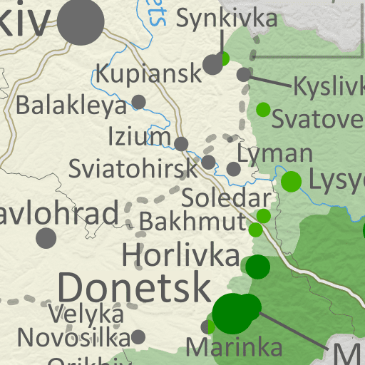
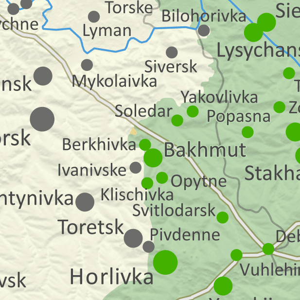
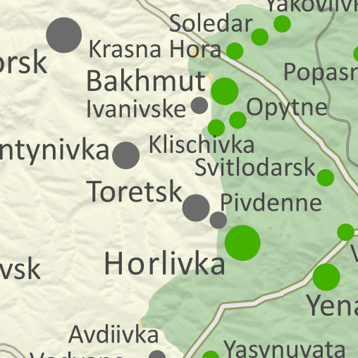
Thumbnail previewing map of Russian-controlled territory in Ukraine on May 27, 2023. In addition to the Crimean peninsula, which Russia had already seized in 2014, and parts of the far eastern Donetsk and Luhansk provinces (the Donbas region) already controlled by Russia-backed separatist rebels (and formerly declared independent as the Donetsk and Lugansk People's Republics), Russian forces still control a wide belt of territory just north of Crimea, including large parts of Kherson and Zaporizhzhia provinces, as well as large additional areas of Donetsk and Luhansk provinces. Meanwhile, all of those provinces are now claimed by the Russian government as parts of Russia, creating a new claimed international border through what was until recently undisputed eastern Ukraine. Map includes key locations from the news, such as Bakhmut (the small city recently captured by Russia), Synkivka, Uman, Pavlohrad, and more. Colorblind accessible.

Russia and its allies have completed their control of Bakhmut in Donetsk province after ten months of bloody battles for the small city. Fighting continues at many other places along the frontlines, including advances for both sides, though more of them in favor of Russia than Ukraine.

See all this and more on the latest update to PolGeoNow's concise, professional Ukraine war control map, which includes a detailed chronicle of changes and events since our previous Ukraine map report of March 26, with sources cited, as well as a close-up map of control within the claimed borders of the Donetsk and Lugansk People's Republics (now claimed to be self-governing regions within Russia).

This map and report are premium content, available to paid subscribers of the PolGeoNow Conflict Mapping Service.

Want to see before you subscribe? Check out our most recent FREE SAMPLE Ukraine map!

Exclusive map report includes:

  • Up-to-date illustration of current territorial control in Ukraine, color-coded for the Ukrainian government on one side and the Russian military and allied forces on the other side, with areas of uncertainty indicated. Colorblind accessible.
  • Darker color indicating which areas were already under Russian or allied control before the 2022 invasion began
  • Lines showing Russia's newly-claimed border after its annexations of Donetsk, Luhansk, Zaporizhzhia, and Kherson provinces.
  • Preview thumbnail of map of territorial control within the claimed borders of the self-declared Donetsk People's Republic (DPR) and Lugansk People's Republic (LPR), which now consider themselves part of Russia, updated to May 27, 2023, after Russia completed its capture of Bakhmut. Map shows that the vast majority of the LPR, otherwise known as Ukraine's Luhansk province, is now under the control of Russia, while Russian forces also control over half of the DPR, or Ukraine's Donetsk province, including the major central and southern cities of Donetsk, Horlivka, Makiyivka, and Mariupol. Includes key locations from the news, such as Novoselivske, Bilohorivka, Soledar, Pervomaiske, and many more. Colorblind accessible.
    Donbas close-up map
    Close-up map of territorial control within the self-proclaimed boundaries of the Donetsk People's Republic and Lugansk People's Republic, which now claim to be part of Russia
  • Detailed indication of city-by-city control, including key towns and other locations important to current events
  • Locations of recent control changes and other important events, including Bakhmut, Synkivka, Uman, Pavlohrad, and more
  • Detailed timeline of important events and changes to territorial control since April 21, 2023, with links to sources.

SUBSCRIBERS CLICK HERE TO VIEW FULL ARTICLE AND MAP:
Old Portal (members.polgeonow.com) | New Portal (controlmaps.polgeonow.com)


Not signed up yet? Click here to learn more about our professional subscription service!

Can I purchase just this map?
This map and report are not available for automated purchase to non-subscribers. If you need access or republication rights for only this map report, contact service@polgeonow.com for options.

Monday, April 24, 2023

Ukraine: Map of Russian Control in April 2023 (Subscription)

SUBSCRIBERS CLICK HERE TO VIEW FULL ARTICLE AND MAP:
Old Portal (members.polgeonow.com) | New Portal (controlmaps.polgeonow.com)


There are newer editions of this map available. To see them, view all Ukraine articles on PolGeoNow.


Research by Djordje Djukic. Map by Evan Centanni and Djordje Djukic

Subscribe for full access to all conflict map reports!

Thumbnail previewing map of Russian-controlled territory in Ukraine on April 21, 2023. In addition to the Crimean peninsula, which Russia had already seized in 2014, and parts of the far eastern Donetsk and Luhansk provinces (the Donbas region) already controlled by Russia-backed separatist rebels (and formerly declared independent as the Donetsk and Lugansk People's Republics), Russian forces still control a wide belt of territory just north of Crimea, including large parts of Kherson and Zaporizhzhia provinces, as well as large additional areas of Donetsk and Luhansk provinces. Meanwhile, all of those provinces are now claimed by the Russian government as parts of Russia, creating a new claimed international border through what was until recently undisputed eastern Ukraine. Map includes key locations from the news, such as Bakhmut, Marinka, Synkivka, Orikhiv, and more. Colorblind accessible.

In recent weeks Russia has continued to slowly advance within the town of Bakhmut, with both sides making small gains in other parts of Donetsk and Luhansk. We've also made some small corrections to the map in Kharkiv and Zaporizhzhia provinces based on new information.

See all this and more on the latest update to PolGeoNow's concise, professional Ukraine war control map, which includes a detailed chronicle of changes and events since our previous Ukraine map report of March 26, with sources cited, as well as a close-up map of control within the claimed borders of the Donetsk and Lugansk People's Republics (now claimed to be self-governing regions within Russia).

This map and report are premium content, available to paid subscribers of the PolGeoNow Conflict Mapping Service.

Want to see before you subscribe? Check out our most recent FREE SAMPLE Ukraine map!

Exclusive map report includes:

  • Up-to-date illustration of current territorial control in Ukraine, color-coded for the Ukrainian government on one side and the Russian military and allied forces on the other side, with areas of uncertainty indicated. Colorblind accessible.
  • Darker color indicating which areas were already under Russian or allied control before the 2022 invasion began
  • Lines showing Russia's newly-claimed border after its annexations of Donetsk, Luhansk, Zaporizhzhia, and Kherson provinces.
  • Preview thumbnail of map of territorial control within the claimed borders of the self-declared Donetsk People's Republic (DPR) and Lugansk People's Republic (LPR), which now consider themselves part of Russia, updated to April 21, 2023. Map shows that the vast majority of the LPR, otherwise known as Ukraine's Luhansk province, is now under the control of Russia, while Russian forces also control over half of the DPR, or Ukraine's Donetsk province, including the major central and southern cities of Donetsk, Horlivka, Makiyivka, and Mariupol. Includes key locations from the news, such as Bakhmut, Marinka, Avdiivka, Bilohorivka, and many more. Colorblind accessible.
    Donbas close-up map
    Close-up map of territorial control within the self-proclaimed boundaries of the Donetsk People's Republic and Lugansk People's Republic, which now claim to be part of Russia
  • Detailed indication of city-by-city control, including key towns and other locations important to current events
  • Locations of recent control changes and other important events, including Bakhmut, Marinka, Avdiivka, Bilohorivka, and many more
  • Detailed timeline of important events and changes to territorial control since March 26, 2023, with links to sources.

SUBSCRIBERS CLICK HERE TO VIEW FULL ARTICLE AND MAP:
Old Portal (members.polgeonow.com) | New Portal (controlmaps.polgeonow.com)


Not signed up yet? Click here to learn more about our professional subscription service!

Can I purchase just this map?
This map and report are not available for automated purchase to non-subscribers. If you need access or republication rights for only this map report, contact service@polgeonow.com for options.