There are newer editions of this map available. To see them, view all Mozambique articles on PolGeoNow.
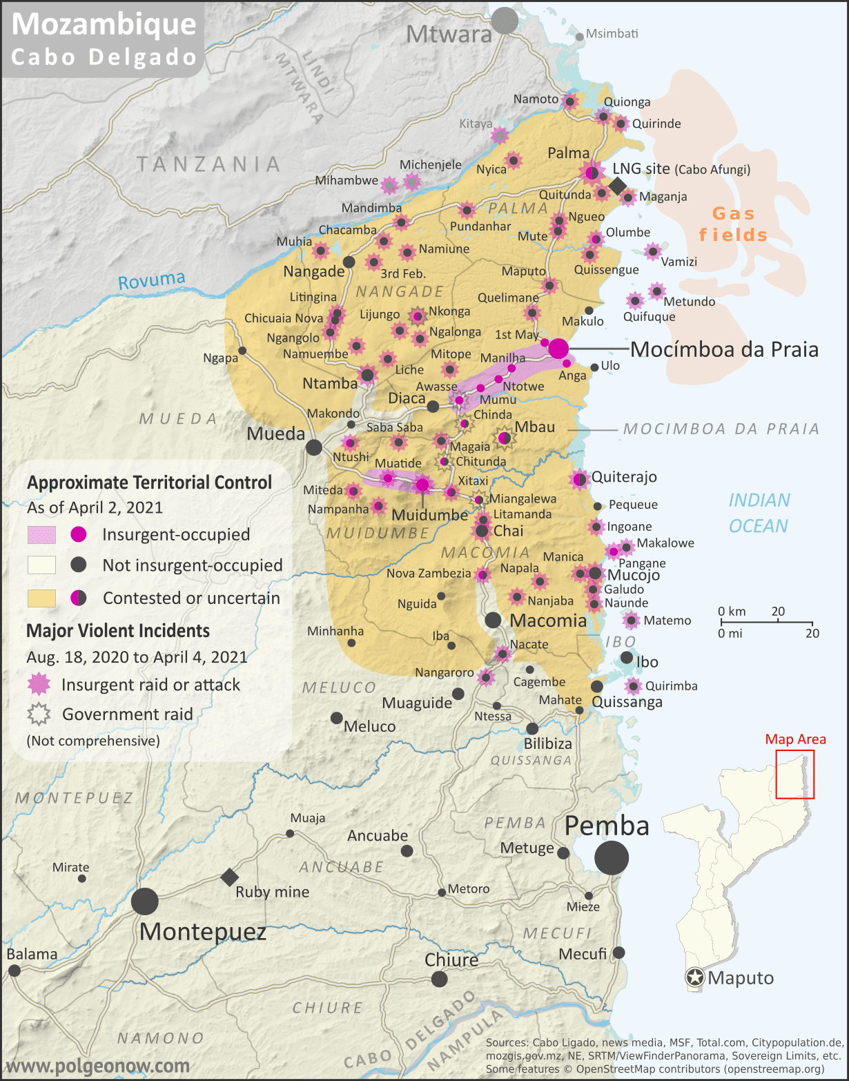
It's finally here: the close-up, super-detailed version of our Mozambique insurgency control map! This edition depicts the situation near the beginning of this month, when the government was fighting for control of Palma. A new close-up version of our August 2020 map is also now available, and future updates are expected more frequently from now on. To see the full list of reports, you can always view all Mozambique articles on PolGeoNow.
 |
Map by Evan Centanni and Djordje Djukic. Some elements © OpenStreetMap contributors. Terrain data sourced from ViewFinderPanoramas. Contact us for permission to use this map.
|
Timeline by Djordje Djukic and Evan Centanni
New: Close-up Cabo Delgado Insurgency Map
In the eight months since our first Mozambique conflict timeline was published, insurgents in Cabo Delgado province have gradually increased their control, continuing to raid villages and towns in multiple districts, culminating most recently in their temporary takeover of most of Palma, a major town close to under-construction natural gas facilities operated by French company Total. The rebel group - locally known as "Al Shabaab" but thought to formally label itself Ahlu Sunnah Wa-Jamâ (ASWJ) - is increasingly believed to be cooperating, if only loosely, with the so-called "Islamic State" (IS; ISIS/ISIL).
Now, for the first time, PolGeoNow presents our close-up map of the Cabo
Delgado conflict, rigorously researched and edited to provide the most
detailed, informative, and reliable map of insurgent control and attacks
available anywhere.


